Area Overview for PR2 1QB
Photos of PR2 1QB
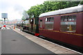
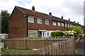
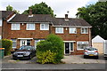
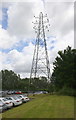
84 photos from this area
Area Information
Key information about the PR2 1QB including its size, population, and administrative classification.
- Area Type
- Postcode
- Area Size
- 1.9 hectares
- Population
- 1810
- Population Density
- 7068 people/km²
House Prices in PR2 1QB
70
Properties
£87,081
Average Sold Price
£32,000
Lowest Price
£132,500
Highest Price
Showing 70 properties
| Address | Type | Beds | Baths | Last Sale Price | Last Sale Date | |
|---|---|---|---|---|---|---|
| 14 Thurnham Road, Preston, PR2 1QB | Terraced | 3 | 1 | £132,500 | Oct 2025 | |
| 24 Thurnham Road, Preston, PR2 1QB | Terraced | 3 | 1 | £120,000 | Feb 2025 | |
| 17 Thurnham Road, Preston, PR2 1QB | Terraced | 3 | 1 | £97,500 | Feb 2024 | |
| 20 Thurnham Road, Preston, PR2 1QB | Detached | 3 | 1 | £115,000 | Oct 2023 | |
| 29 Thurnham Road, Preston, PR2 1QB | house | - | - | £99,000 | Dec 2022 | |
| 42 Thurnham Road, Preston, PR2 1QB | house | - | - | £65,000 | Nov 2021 | |
| 6 Thurnham Road, Preston, PR2 1QB | house | 2 | 1 | £90,000 | May 2021 | |
| 45 Thurnham Road, Preston, PR2 1QB | Terraced | 3 | 1 | £98,000 | Sep 2020 | |
| 58 Thurnham Road, Preston, PR2 1QB | Terraced | 3 | 1 | £96,500 | Jan 2020 | |
| 28 Thurnham Road, Preston, PR2 1QB | Terraced | 3 | 1 | £93,000 | Jan 2020 |
Page 1 of 7
Energy Efficiency in PR2 1QB
Amenities
Schools
| Rank | School | Type | Entry gender | Ages |
|---|
Explore more schools in this area
Go to Schools tabDemographics
Household Size
One person
most common
Accommodation Type
Houses
most common
Tenure
47
majority
Ethnic Group
White
most common
Religion
N/A
most common
Household Composition
N/A
most common
Age
47
median
Adults (30-64 years)
most common
Household Deprivation
N/A
with no deprivation
NS-SEC
21
in Lower managerial occupations
Explore more demographic insights in this area
Go to Demographics tabPlanning
Planning Constraints
- Flood RiskPremium
- Ramsar Wetland SitesPremium
- Area of Outstanding Natural BeautyPremium
- Protected Nature ReservePremium
- Protected WoodlandPremium