Area Overview for PR2 1DB
Photos of PR2 1DB

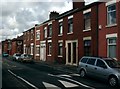

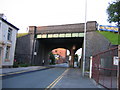
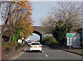
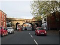
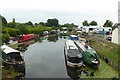
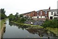
90 photos from this area
Area Information
Key information about the PR2 1DB including its size, population, and administrative classification.
- Area Type
- Postcode
- Area Size
- 5675 m²
- Population
- 1533
- Population Density
- 270140 people/km²
House Prices in PR2 1DB
41
Properties
£98,634
Average Sold Price
£33,000
Lowest Price
£147,950
Highest Price
Showing 41 properties
| Address | Type | Beds | Baths | Last Sale Price | Last Sale Date | |
|---|---|---|---|---|---|---|
| 72 Waterloo Terrace, Preston, PR2 1DB | Terraced | 2 | 1 | £90,000 | Oct 2024 | |
| The Chip Inn, 36 Waterloo Terrace, Preston, PR2 1DB | Flat | - | - | £140,000 | Jul 2024 | |
| 32 Waterloo Terrace, Preston, PR2 1DB | house | 4 | - | £135,000 | Jun 2024 | |
| 8 Waterloo Terrace, Preston, PR2 1DB | Terraced | 2 | 1 | £120,000 | Mar 2023 | |
| 24 Waterloo Terrace, Preston, PR2 1DB | Terraced | 4 | 1 | £147,950 | Dec 2022 | |
| 62 Waterloo Terrace, Preston, PR2 1DB | house | 3 | 1 | £118,000 | Dec 2022 | |
| 50 Waterloo Terrace, Preston, PR2 1DB | house | 3 | - | £145,000 | Oct 2022 | |
| 64 Waterloo Terrace, Preston, PR2 1DB | Terraced | 2 | 1 | £126,000 | Jun 2022 | |
| 48 Waterloo Terrace, Preston, PR2 1DB | Retail | 3 | 1 | £145,000 | Jun 2022 | |
| 30 Waterloo Terrace, Preston, PR2 1DB | house | 3 | 1 | £114,000 | Nov 2021 |
Page 1 of 5
Energy Efficiency in PR2 1DB
Amenities
Schools
| Rank | School | Type | Entry gender | Ages |
|---|
Explore more schools in this area
Go to Schools tabDemographics
Household Size
One person
most common
Accommodation Type
Houses
most common
Tenure
45
majority
Ethnic Group
White
most common
Religion
N/A
most common
Household Composition
N/A
most common
Age
47
median
Adults (30-64 years)
most common
Household Deprivation
N/A
with no deprivation
NS-SEC
28
in Lower managerial occupations
Explore more demographic insights in this area
Go to Demographics tabPlanning
Planning Constraints
- Flood RiskPremium
- Ramsar Wetland SitesPremium
- Area of Outstanding Natural BeautyPremium
- Protected Nature ReservePremium
- Protected WoodlandPremium