Area Overview for PR1 8XA
Photos of PR1 8XA


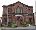
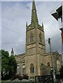


100 photos from this area
Area Information
Key information about the PR1 8XA including its size, population, and administrative classification.
- Area Type
- Postcode
- Area Size
- 9647 m²
- Population
- 2675
- Population Density
- 4025 people/km²
House Prices in PR1 8XA
4
Properties
-
Average Sold Price
-
Lowest Price
-
Highest Price
Showing 4 properties
| Address | Type | Beds | Baths | Last Sale Price | Last Sale Date | |
|---|---|---|---|---|---|---|
| Tom Parker (h And P) Limited, Unit 4, The Old Brewery Trading Estate, Mona Place, Preston, PR1 8XA | Industrial | - | - | - | - | |
| Glendale Turf Company, Unit 9, The Old Brewery Trading Estate, Mona Place, Preston, PR1 8XA | Industrial | - | - | - | - | |
| Tom Parker (h And P) Limited, Unit 3, The Old Brewery Trading Estate, Mona Place, Preston, PR1 8XA | office_workshop | - | - | - | - | |
| Tom Parker Limited, Units 3 And 4, The Old Brewery Trading Estate, Mona Place, Preston, PR1 8XA | office_workshop | - | - | - | - |
Energy Efficiency in PR1 8XA
Amenities
Schools
| Rank | School | Type | Entry gender | Ages |
|---|
Explore more schools in this area
Go to Schools tabDemographics
Household Size
One person
most common
Accommodation Type
Houses
most common
Tenure
41
majority
Ethnic Group
White
most common
Religion
N/A
most common
Household Composition
N/A
most common
Age
22
median
Young Adults (15-29 years)
most common
Household Deprivation
N/A
with no deprivation
NS-SEC
11
in Lower managerial occupations
Explore more demographic insights in this area
Go to Demographics tabPlanning
Planning Constraints
- Flood RiskPremium
- Ramsar Wetland SitesPremium
- Area of Outstanding Natural BeautyPremium
- Protected Nature ReservePremium
- Protected WoodlandPremium