Area Overview for PR1 7UR
Photos of PR1 7UR
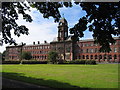
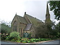
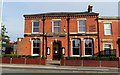
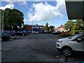
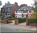
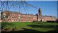
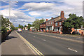
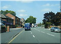
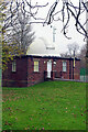
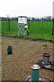
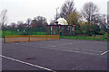
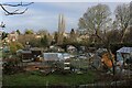
26 photos from this area
Area Information
Key information about the PR1 7UR including its size, population, and administrative classification.
- Area Type
- Postcode
- Area Size
- 7844 m²
- Population
- 1710
- Population Density
- 9309 people/km²
House Prices in PR1 7UR
28
Properties
£138,784
Average Sold Price
£40,000
Lowest Price
£248,000
Highest Price
Showing 28 properties
| Address | Type | Beds | Baths | Last Sale Price | Last Sale Date | |
|---|---|---|---|---|---|---|
| 84 Brackenbury Road, Preston, PR1 7UR | Terraced | 3 | 1 | £200,000 | Apr 2025 | |
| 4, Holmes Court, Brackenbury Road, Preston, PR1 7UR | Flat | - | - | £109,500 | Mar 2024 | |
| 91 Brackenbury Road, Preston, PR1 7UR | house | 7 | 4 | £247,500 | Dec 2023 | |
| 92 Brackenbury Road, Preston, PR1 7UR | Flat | 3 | - | £155,000 | Oct 2023 | |
| 85 Brackenbury Road, Preston, PR1 7UR | house | 1 | 2 | £248,000 | Jul 2023 | |
| 83 Brackenbury Road, Preston, PR1 7UR | house | 1 | 4 | £248,000 | Jul 2023 | |
| 93 Brackenbury Road, Preston, PR1 7UR | Terraced | 6 | 3 | £218,500 | Dec 2022 | |
| 87 Brackenbury Road, Preston, PR1 7UR | Terraced | 4 | 1 | £225,000 | Jan 2022 | |
| 1, Holmes Court, Brackenbury Road, Preston, PR1 7UR | Flat | - | - | £112,500 | Sep 2021 | |
| 3, Holmes Court, Brackenbury Road, Preston, PR1 7UR | Maisonette | - | - | £85,000 | Jan 2019 |
Page 1 of 3
Energy Efficiency in PR1 7UR
Amenities
Schools
| Rank | School | Type | Entry gender | Ages |
|---|
Explore more schools in this area
Go to Schools tabDemographics
Household Size
Family (3-5 people)
most common
Accommodation Type
Houses
most common
Tenure
58
majority
Ethnic Group
White
most common
Religion
N/A
most common
Household Composition
N/A
most common
Age
47
median
Adults (30-64 years)
most common
Household Deprivation
N/A
with no deprivation
NS-SEC
25
in Lower managerial occupations
Explore more demographic insights in this area
Go to Demographics tabPlanning
Planning Constraints
- Flood RiskPremium
- Ramsar Wetland SitesPremium
- Area of Outstanding Natural BeautyPremium
- Protected Nature ReservePremium
- Protected WoodlandPremium