Area Overview for PR1 6TD
Photos of PR1 6TD

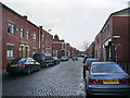

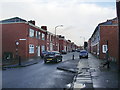
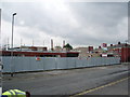
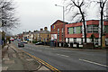
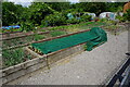
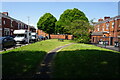
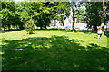
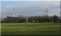
50 photos from this area
Area Information
Key information about the PR1 6TD including its size, population, and administrative classification.
- Area Type
- Postcode
- Area Size
- 2.4 hectares
- Population
- 1764
- Population Density
- 8588 people/km²
House Prices in PR1 6TD
26
Properties
£82,555
Average Sold Price
£24,000
Lowest Price
£195,000
Highest Price
Showing 26 properties
| Address | Type | Beds | Baths | Last Sale Price | Last Sale Date | |
|---|---|---|---|---|---|---|
| 134 St Stephens Road, Preston, PR1 6TD | house | - | - | £40,000 | Jul 2022 | |
| 110 St Stephens Road, Preston, PR1 6TD | house | - | - | £195,000 | Apr 2022 | |
| 126 St Stephens Road, Preston, PR1 6TD | house | - | - | £100,000 | Jan 2017 | |
| 142 St Stephens Road, Preston, PR1 6TD | house | - | - | £128,000 | Oct 2015 | |
| 150 St Stephens Road, Preston, PR1 6TD | Terraced | 3 | 2 | £124,000 | Sep 2011 | |
| 118 St Stephens Road, Preston, PR1 6TD | house | - | - | £104,000 | Dec 2010 | |
| 140 St Stephens Road, Preston, PR1 6TD | Terraced | 3 | - | £89,210 | Jun 2006 | |
| 152 St Stephens Road, Preston, PR1 6TD | house | - | - | £108,000 | Jun 2005 | |
| 138 St Stephens Road, Preston, PR1 6TD | Terraced | - | - | £35,000 | Jun 2004 | |
| 132 St Stephens Road, Preston, PR1 6TD | Terraced | - | - | £30,000 | Aug 2002 |
Page 1 of 3
Energy Efficiency in PR1 6TD
Amenities
Schools
| Rank | School | Type | Entry gender | Ages |
|---|
Explore more schools in this area
Go to Schools tabDemographics
Household Size
Family (3-5 people)
most common
Accommodation Type
Houses
most common
Tenure
73
majority
Ethnic Group
asian_total
most common
Religion
N/A
most common
Household Composition
N/A
most common
Age
47
median
Adults (30-64 years)
most common
Household Deprivation
N/A
with no deprivation
NS-SEC
16
in Lower managerial occupations
Explore more demographic insights in this area
Go to Demographics tabPlanning
Planning Constraints
- Flood RiskPremium
- Ramsar Wetland SitesPremium
- Area of Outstanding Natural BeautyPremium
- Protected Nature ReservePremium
- Protected WoodlandPremium