Area Overview for PR1 5US
Photos of PR1 5US

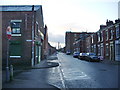
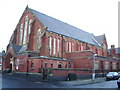
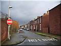
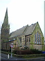
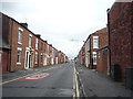
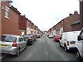
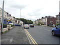
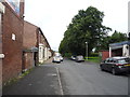
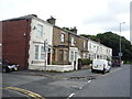
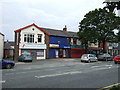
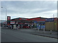
34 photos from this area
Area Information
Key information about the PR1 5US including its size, population, and administrative classification.
- Area Type
- Postcode
- Area Size
- 7095 m²
- Population
- 2386
- Population Density
- 9299 people/km²
House Prices in PR1 5US
40
Properties
£70,857
Average Sold Price
£15,484
Lowest Price
£140,000
Highest Price
Showing 40 properties
| Address | Type | Beds | Baths | Last Sale Price | Last Sale Date | |
|---|---|---|---|---|---|---|
| 315 Cemetery Road, Preston, PR1 5US | house | - | - | £140,000 | Jul 2025 | |
| 63 Cemetery Road, Preston, PR1 5US | Terraced | 2 | 1 | £115,000 | Oct 2024 | |
| 1 Cemetery Road, Preston, PR1 5US | Terraced | 2 | 1 | £72,500 | Dec 2023 | |
| 4 Cemetery Road, Preston, PR1 5US | Terraced | 3 | 1 | £70,000 | Jul 2020 | |
| 66 Cemetery Road, Preston, PR1 5US | house | 3 | - | £69,950 | Jul 2018 | |
| 65 Cemetery Road, Preston, PR1 5US | Terraced | 3 | 1 | £90,000 | Jun 2018 | |
| 323 Cemetery Road, Preston, PR1 5US | house | 2 | - | £70,000 | Oct 2016 | |
| 3 Cemetery Road, Preston, PR1 5US | Terraced | 2 | 1 | £64,000 | Sep 2016 | |
| 313 Cemetery Road, Preston, PR1 5US | retail_financial | - | - | £120,000 | Sep 2016 | |
| 314 Cemetery Road, Preston, PR1 5US | house | - | - | £90,000 | Sep 2016 |
Page 1 of 4
Energy Efficiency in PR1 5US
Amenities
Schools
| Rank | School | Type | Entry gender | Ages |
|---|
Explore more schools in this area
Go to Schools tabDemographics
Household Size
Family (3-5 people)
most common
Accommodation Type
Houses
most common
Tenure
39
majority
Ethnic Group
White
most common
Religion
N/A
most common
Household Composition
N/A
most common
Age
47
median
Adults (30-64 years)
most common
Household Deprivation
N/A
with no deprivation
NS-SEC
12
in Lower managerial occupations
Explore more demographic insights in this area
Go to Demographics tabPlanning
Planning Constraints
- Flood RiskPremium
- Ramsar Wetland SitesPremium
- Area of Outstanding Natural BeautyPremium
- Protected Nature ReservePremium
- Protected WoodlandPremium