Area Overview for PR1 0SR
Photos of PR1 0SR

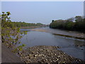
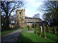
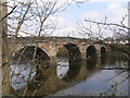
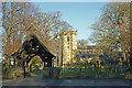

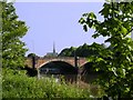
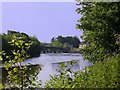
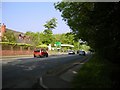
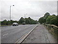
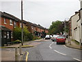
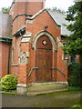
99 photos from this area
Area Information
Key information about the PR1 0SR including its size, population, and administrative classification.
- Area Type
- Postcode
- Area Size
- 4.0 hectares
- Population
- 1382
- Population Density
- 1271 people/km²
House Prices in PR1 0SR
22
Properties
£223,454
Average Sold Price
£58,500
Lowest Price
£487,500
Highest Price
Showing 22 properties
| Address | Type | Beds | Baths | Last Sale Price | Last Sale Date | |
|---|---|---|---|---|---|---|
| 54 Cop Lane, Penwortham, PR1 0SR | Detached | 4 | 2 | £414,000 | Feb 2025 | |
| 64 Cop Lane, Penwortham, PR1 0SR | house | - | - | £487,500 | Nov 2020 | |
| 44 Cop Lane, Penwortham, PR1 0SR | Semi-detached | 3 | 1 | £245,000 | Sep 2020 | |
| 50 Cop Lane, Penwortham, PR1 0SR | Semi-detached | 3 | 2 | £250,000 | Jun 2019 | |
| The Water Tower, 2 Cop Lane, Penwortham, PR1 0SR | Semi-detached | 5 | 2 | £290,000 | Jun 2018 | |
| 62 Cop Lane, Penwortham, PR1 0SR | Semi-detached | 3 | 1 | £294,950 | Apr 2018 | |
| 30 Cop Lane, Penwortham, PR1 0SR | house | - | - | £238,000 | Oct 2010 | |
| 48 Cop Lane, Penwortham, PR1 0SR | Bungalow | - | - | £200,000 | Jun 2009 | |
| 38 Cop Lane, Penwortham, PR1 0SR | Semi-detached | - | - | £143,000 | Apr 2003 | |
| 40 Cop Lane, Penwortham, PR1 0SR | house | - | - | £84,950 | Feb 2001 |
Page 1 of 3
Energy Efficiency in PR1 0SR
Amenities
Schools
| Rank | School | Type | Entry gender | Ages |
|---|
Explore more schools in this area
Go to Schools tabDemographics
Household Size
Two person
most common
Accommodation Type
Houses
most common
Tenure
86
majority
Ethnic Group
White
most common
Religion
N/A
most common
Household Composition
N/A
most common
Age
47
median
Adults (30-64 years)
most common
Household Deprivation
N/A
with no deprivation
NS-SEC
50
in Lower managerial occupations
Explore more demographic insights in this area
Go to Demographics tabPlanning
Planning Constraints
- Flood RiskPremium
- Ramsar Wetland SitesPremium
- Area of Outstanding Natural BeautyPremium
- Protected Nature ReservePremium
- Protected WoodlandPremium