Area Overview for PR1 0PJ
Photos of PR1 0PJ
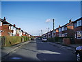
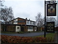
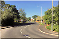
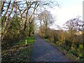
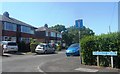
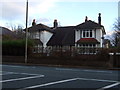
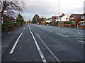
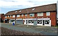
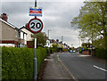
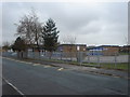
10 photos from this area
Area Information
Key information about the PR1 0PJ including its size, population, and administrative classification.
- Area Type
- Postcode
- Area Size
- 3.3 hectares
- Population
- 1341
- Population Density
- 2703 people/km²
House Prices in PR1 0PJ
58
Properties
£197,150
Average Sold Price
£63,000
Lowest Price
£336,000
Highest Price
Showing 58 properties
| Address | Type | Beds | Baths | Last Sale Price | Last Sale Date | |
|---|---|---|---|---|---|---|
| 46 Cherry Wood, Penwortham, PR1 0PJ | Bungalow | 2 | 1 | £254,000 | Mar 2025 | |
| 26 Cherry Wood, Penwortham, PR1 0PJ | Detached | 4 | 2 | £279,000 | May 2024 | |
| 30 Cherry Wood, Penwortham, PR1 0PJ | Detached | 5 | 2 | £310,000 | Apr 2024 | |
| 37 Cherry Wood, Penwortham, PR1 0PJ | Detached | 4 | 2 | £305,000 | Jul 2023 | |
| 20 Cherry Wood, Penwortham, PR1 0PJ | Detached | 3 | 2 | £336,000 | Oct 2022 | |
| 29 Cherry Wood, Penwortham, PR1 0PJ | house | - | - | £250,000 | Jan 2022 | |
| 52 Cherry Wood, Penwortham, PR1 0PJ | Bungalow | - | - | £260,000 | Dec 2021 | |
| 39 Cherry Wood, Penwortham, PR1 0PJ | Bungalow | 3 | 2 | £245,000 | Mar 2021 | |
| 5 Cherry Wood, Penwortham, PR1 0PJ | house | - | - | £250,000 | Sep 2020 | |
| 66 Cherry Wood, Penwortham, PR1 0PJ | Detached | 3 | - | £210,000 | Jun 2020 |
Page 1 of 6
Energy Efficiency in PR1 0PJ
Amenities
Schools
| Rank | School | Type | Entry gender | Ages |
|---|
Explore more schools in this area
Go to Schools tabDemographics
Household Size
Family (3-5 people)
most common
Accommodation Type
Houses
most common
Tenure
95
majority
Ethnic Group
White
most common
Religion
N/A
most common
Household Composition
N/A
most common
Age
47
median
Adults (30-64 years)
most common
Household Deprivation
N/A
with no deprivation
NS-SEC
47
in Lower managerial occupations
Explore more demographic insights in this area
Go to Demographics tabPlanning
Planning Constraints
- Flood RiskPremium
- Ramsar Wetland SitesPremium
- Area of Outstanding Natural BeautyPremium
- Protected Nature ReservePremium
- Protected WoodlandPremium