Area Overview for Poulton North Ward
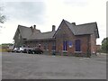
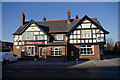
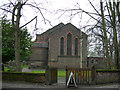
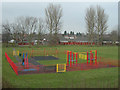
Photos of Poulton North Ward
Area Information
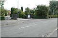
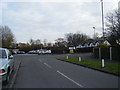
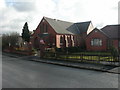
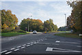
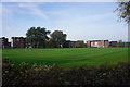
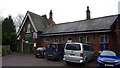
Living in Poulton North Ward offers a distinctly quiet residential experience within a small geographic footprint. This ward covers an area of 3.3 km², creating a compact neighbourhood where daily routines do not require extensive driving. The location is firmly situated in the Warrington area of Cheshire, approximately 40 miles south-east of Poulton-le-Fylde. It serves as a focused district borough unitary ward rather than a sprawling urban centre. Residents here enjoy a settled environment defined by its limited physical space and its position relative to the wider Blackpool Urban Area. You are not surrounded by the hustle of a major city, yet you remain connected to the regional transport network. The character of the area is shaped by its specific administrative status and its distance from the Lancashire coast. While Poulton-le-Fylde is a market town on the Fylde coastal plain, Poulton North Ward operates as a discrete entity within the Warrington boundary. Daily life here revolves around the practicalities of a small, stable community. The ward does not contain protected nature reserves, protected woodland, or Ramsar wetland sites, indicating a landscape managed primarily for residential purposes. You will find a neighbourhood that prioritises housing stability over large-scale industrial or conservation zones. This setting appeals to those seeking a defined home base without the complexity of expansive planning constraints or remote isolation.
- Area Type
- District Borough Unitary Ward
- Area Size
- 3.3 km²
- Population
- Not available
- Population Density
- Not available
Demographics
The community in Poulton North Ward is defined by a significantly mature population profile. The median age stands at 70, a figure that shapes how the neighbourhood functions on a daily basis. This suggests the area is heavily populated by older residents who may favour established routines and quieter surroundings. Housing in Poulton North Ward reflects this demographic reality, with 71% of properties being owner-occupied. This high rate of home ownership indicates a long-term resident base rather than a transient rental market. You are likely to encounter neighbours who have invested in their homes for decades. The ward composition supports a lifestyle where residents take ownership of their immediate environment. Accommodation types and household structures align with the older median age. There is no data on predominant ethnic groups or religious affiliations provided for this specific ward, so the community appears homogeneous in its recorded characteristics. The explicit mention of "Age: Total" as the most common age range reinforces that the entire population leans towards the older demographic bracket. This concentration means services and amenities likely cater to the needs of those with lower mobility or a desire for nearby support networks. You are entering a space where the population is not diluted by young families or a large student cohort. The social fabric is woven from generations of residents who have remained in their homes for long periods.
Household Size
Accommodation Type
Tenure
Ethnic Group
Religion
Household Composition
Age
Household Deprivation
NS-SEC
Explore more demographic insights in this area
Go to Demographics tabPlanning
Planning Constraints
- Flood RiskPremium
- Ramsar Wetland SitesPremium
- Area of Outstanding Natural BeautyPremium
- Protected Nature ReservePremium
- Protected WoodlandPremium
- Crime RiskPremium