Area Overview for Poulton Ward
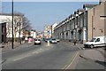
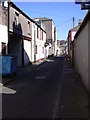
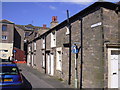
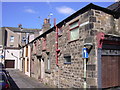
Photos of Poulton Ward


Area Information
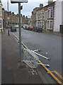
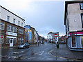
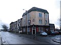
Poulton Ward is a small district borough unitary ward situated in England, covering an area of just 1.6 km². The location lies within the broader Poulton-le-Fylde region, which serves as a market town and unparished area in the Wyre District of Lancashire. This specific ward sits approximately 5 miles north-east of Blackpool town centre and 16.5 miles north-west of Preston, placing it firmly within the Blackpool Urban Area. You find yourself in a community shaped by its history, with evidence of human habitation dating back 12,000 years and ancient ecclesiastical ties to the Hundred of Amounderness. The landscape transitions from a compact historic core surrounding a central marketplace to post-World War II housing developments on the outskirts. Nearby landmarks include the old town hall, the railway station served by Northern Trains and Avanti West Coast, and adjacent villages such as Bispham and Hardhorn. Daily life here involves proximity to the River Wyre and the Irish Sea, offering a blend of suburban convenience with coastal access. The ward functions as part of a larger economic zone linked to major transport networks including the M55 motorway at Greenhalgh. Residents enjoy direct links to Fylde towns, Over Wyre villages, and Preston via various bus operators and road connections. This compact size means the area feels intimate, yet its transport links ensure residents remain well-connected to the wider North West of England.
- Area Type
- District Borough Unitary Ward
- Area Size
- 1.6 km²
- Population
- Not available
- Population Density
- Not available
Demographics
The community profile of Poulton Ward reflects a mature population, with a median age of 70 years. Age demographics indicate that the total population skews heavily towards older residents, suggesting the ward attracts retirees or families with grown children who have moved to the region. Home ownership stands at 43 per cent, meaning you are more than twice as likely to rent your property than to own it outright in this specific ward. This figure indicates a significant rental component within the local housing stock, distinguishing it from areas where ownership dominates. While the data does not specify a most common age range beyond the total classification or detail ethnic group and religious breakdowns, the high median age is a defining characteristic of the area. The ward accommodates a diverse mix of household compositions and accommodation types, reflecting its role as part of the larger Poulton-le-Fylde urban area. You should note that this demographic structure often correlates with quieter streets and a slower pace of life. However, the relatively low ownership rate implies a dynamic rental market where tenancy changes occur more frequently than in owner-occupied estates. The presence of educational institutions like Baines School and Hodgson Academy nearby serves the surrounding towns, even if the primary population here consists of adults and seniors. Living here offers an environment tailored to those seeking stability and established community ties rather than rapid urban expansion.
Household Size
Accommodation Type
Tenure
Ethnic Group
Religion
Household Composition
Age
Household Deprivation
NS-SEC
Explore more demographic insights in this area
Go to Demographics tabPlanning
Planning Constraints
- Flood RiskPremium
- Ramsar Wetland SitesPremium
- Area of Outstanding Natural BeautyPremium
- Protected Nature ReservePremium
- Protected WoodlandPremium
- Crime RiskPremium