Area Overview for Portinscale
Photos of Portinscale


Area Information
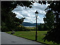
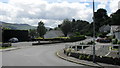
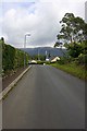
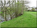
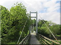
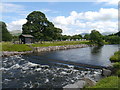
Portinscale is a compact built-up area in England, spanning 37 hectares. Its small size means the community feels closely knit, with residents accustomed to a slower pace of life. The area’s demographic profile suggests a mature population, with a median age of 70, indicating a community that may lean towards retirement or long-term residency. Home ownership is high at 78%, reflecting a stable housing market where many properties are owner-occupied. Daily life in Portinscale is shaped by its proximity to waterways, with five ferry landings within practical reach, including Nichol End Ferry Landing and Lingholm Jetty. These connections to water suggest a lifestyle centred on accessibility and local travel. Retail options are modest but functional, with Spar, Booths Keswick, and Co-op Keswick providing essential services. While the area lacks large-scale amenities, its compact nature ensures that essentials are within walking or short driving distance. For those considering living in Portinscale, the blend of practicality, safety, and connectivity to nearby water transport makes it a viable option for those prioritising convenience over urban vibrancy.
- Area Type
- Built Up Area 250
- Area Size
- 37.0 hectares
- Population
- Not available
- Population Density
- Not available
Residents of Portinscale have access to a selection of nearby amenities that cater to daily needs. Retail options include Spar, Booths Keswick, and Co-op Keswick, providing essentials like groceries and household items. These stores are within practical reach, making them convenient for routine shopping. The area’s five ferry landings—such as Nichol End Ferry Landing and Lingholm Jetty—suggest a lifestyle that incorporates water-based travel, whether for commuting, leisure, or accessing nearby towns. While the data does not mention parks or recreational facilities, the presence of ferries implies a connection to natural environments, which could be a draw for those seeking a relaxed pace of life. The compact nature of Portinscale ensures that amenities are not overly distant, though the variety is modest. For those prioritising convenience over extensive leisure options, the area’s practical layout may be appealing.
Amenities
Schools
| Rank | A + A* % | School | Type | Entry gender | Ages |
|---|
Explore more schools in this area
Go to Schools tabDemographics
Portinscale’s population is characterised by a median age of 70, with the most common age range encompassing all demographics. This suggests a community that is predominantly older, possibly with a significant proportion of retirees or long-term residents. Home ownership is high at 78%, indicating that most residents live in properties they own rather than rent. The data does not specify household composition or accommodation types, but the overall home ownership rate implies a stable, settled population. The area’s demographic profile does not provide details on ethnic diversity or religious composition, so these aspects remain unspecified. For those considering Portinscale, the high home ownership rate and mature age profile suggest a community with a focus on long-term residency rather than transient populations. The lack of detailed data on diversity means further local research may be needed for a fuller understanding of the area’s social fabric.
Household Size
Accommodation Type
Tenure
Ethnic Group
Religion
Household Composition
Age
Household Deprivation
NS-SEC
Explore more demographic insights in this area
Go to Demographics tabPlanning
Planning Constraints
- Crime RiskLocked