Area Overview for Pensby and Thingwall Ward
Photos of Pensby and Thingwall Ward

Area Information
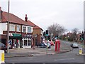
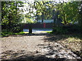
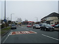
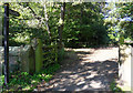
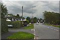
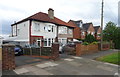
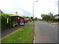
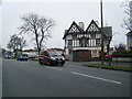
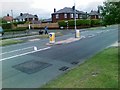
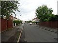
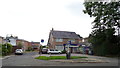
Living in Pensby and Thingwall Ward offers a distinctly rural experience within the Metropolitan Borough of Wirral. This district borough unitary ward spans 10.9 square kilometres and holds a population of 1,574 residents. The area functions as two separate villages, with the ward name combining Pensby, located 1.5 miles north of Heswall, and Thingwall, situated 8 km southwest of Birkenhead. You will find both settlements centred around coordinates 53.36992029866088, -3.0964429966354197, accessed via the postcode CH49 5PE. The geography is defined by the Dee Estuary to the west and the Mersey to the east, placing you firmly on the Wirral Peninsula. Historically, these locations were townships in the parish of Woodchurch before becoming civil parishes in 1866. A local government reorganisation in 1974 transferred authority from Cheshire to Merseyside, creating the current Metropolitan Borough of Wirral. Daily life here revolves around village settings rather than urban density, providing a quiet alternative to nearby cities while maintaining links to the wider Merseyside region.
- Area Type
- District Borough Unitary Ward
- Area Size
- 10.9 km²
- Population
- 1574
- Population Density
- 144 people/km²
Demographics
The community in Pensby and Thingwall Ward is defined by a stationary age profile and high rates of home ownership. You will find that the median age for residents is 70 years old, making it one of the oldest populations in Merseyside. This demographic reality is underscored by the fact that the most common age grouping recorded is simply 'Age: Total', suggesting a highly stable population without significant youth inflow. Over 82% of households report they own their property outright, indicating that this is a suburb where long-term settlement is the norm rather than a transient rental market. The ward accommodates 1,574 individuals across a relatively small 10.9 km² landscape, resulting in a density of 144 people per square kilometre. This figure translates to a low-density environment where you are unlikely to see the crowding typical of city centres. While specific data on predominant ethnicity or religious breakdown is not explicitly detailed in the provided records, the overwhelming evidence points to a settled, owner-occupied community driven by retirees rather than young families or mobile workers.
Household Size
Accommodation Type
Tenure
Ethnic Group
Religion
Household Composition
Age
Household Deprivation
NS-SEC
Explore more demographic insights in this area
Go to Demographics tabPlanning
Planning Constraints
- Flood RiskLocked
- Ramsar Wetland SitesLocked
- Area of Outstanding Natural BeautyLocked
- Protected Nature ReserveLocked
- Protected WoodlandLocked
- Crime RiskLocked