Area Overview for Pendleton & Charlestown Ward
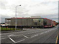
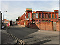
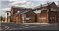
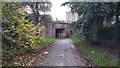
Photos of Pendleton & Charlestown Ward
Area Information
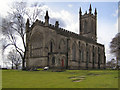
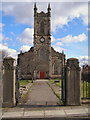
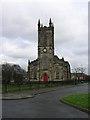
Pendleton & Charlestown Ward sits approximately two miles north-west of Manchester city centre. The ward forms part of the City of Salford in Greater Manchester and occupies an area of 4.2 square kilometres. A population of 3,106 residents lives within these boundaries, making the district relatively compact. This inner-city ward lies at a strategic junction connecting to Liverpool, Preston, Bolton, and Manchester. The River Irwell separates the district from the city centre to the south. Resistance Street serves as a major thoroughfare running through the area. The ward is defined by its history on the Manchester Coalfield and its proximity to the Manchester, Bolton & Bury Canal. Connectivity relies heavily on the A6 dual carriageway which skirts the east of the district. Pendleton railway station closed in 1998 following an arson attack. Residents rely on Salford Crescent railway station for links to Piccadilly, Oxford Road, and Victoria stations. The area underwent significant transformation after the 2011 riots when Salford City Council announced a regeneration scheme. Today, the ward remains fundamentally urban. You will encounter St Thomas Church and Buile Hill Park, the largest public park in the area. The Pendleton Fault runs beneath the ground, marking the district as geologically active in the region.
- Area Type
- District Borough Unitary Ward
- Area Size
- 4.2 km²
- Population
- 3243
- Population Density
- 772 people/km²
Demographics
The community in Pendleton & Charlestown Ward has a median age of 70 years. This figure indicates a population skewed significantly towards older residents. The ward contains a total of 3,106 people according to recent census data for the area. Only 23% of residents own their homes outright. This low ownership figure suggests that the majority of households operate within the private rental sector or reside in social housing. The ward exhibits a diverse demographic composition. White residents make up 72.4% of the population. Black residents account for 13.1% of the total population. Asian residents represent 5.7% of the community. The remaining demographic groups contribute to the ward's cultural mix. The household composition data reflects a community where families share spaces or live alone in a high proportion of cases. The percentage of diverse ethnic groups mirrors the wider diversity of Greater Manchester. You can find residents from various backgrounds living in the same neighbourhoods. The age profile means that local facilities must cater specifically to elderly needs. This demographic reality shapes the demand for health services and leisure amenities near the area. Living here requires understanding the needs of an older population.
Household Size
Accommodation Type
Tenure
Ethnic Group
Religion
Household Composition
Age
Household Deprivation
NS-SEC
Explore more demographic insights in this area
Go to Demographics tabPlanning
Planning Constraints
- Flood RiskPremium
- Ramsar Wetland SitesPremium
- Area of Outstanding Natural BeautyPremium
- Protected Nature ReservePremium
- Protected WoodlandPremium