Area Overview for Patterdale
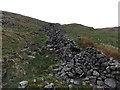
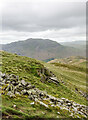
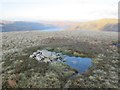
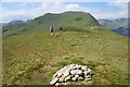
Photos of Patterdale
Area Information
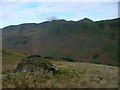
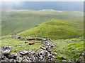
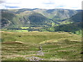
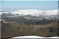
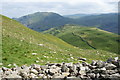
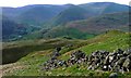
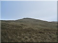
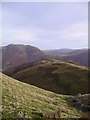
Living in Patterdale means settling into a small village and civil parish located within the Lake District National Park. This rural settlement sits in the eastern part of Cumbria, specifically in the Ullswater Valley, also known as Saint Patrick's Dale. The area covers a significant span of 67.7 km², providing ample space for residents to enjoy the surrounding natural landscape while maintaining a close-knit community feel. You are situated approximately 7 miles south-west of Pooley Bridge and 8 miles north of Ambleside, placing you at a strategic point within the wider region. The village centre revolves around landmarks such as Patterdale Hall, which serves as an outdoor pursuits centre and estate, and the Patterdale Church, consecrated in 1853. Daily life here is shaped by a strong farming community coupled with historical mining links to Glenridding. Local heritage is evident in features like the King George V playing field, purchased by the community in 1937 from the estate. While the town is small, it offers access to notable local history, including the residence of the so-called "King of Patterdale," John Mounsey. Whether you seek quiet contemplation amidst protected nature reserves or active engagement with holiday pursuits, the parish offers a distinct alternative to larger urban centres in Cumbria. It is a place defined by its location in the Lake District and its deep historical roots.
- Area Type
- Parish
- Area Size
- 67.7 km²
- Population
- Not available
- Population Density
- Not available
Demographics
The social structure of Patterdale reflects a mature, settled population. The median age in the area stands at 70 years, indicating that the community is predominantly composed of older residents. This demographic profile suggests a neighbourhood where long-term families and retirees form the backbone of society, rather than young professionals or students. Ownership of property is highly prevalent; roughly 73% of households in Patterdale are owner-occupied. This high rate of home ownership points to a stable residents who have invested deeply in their local homes. You will find that accommodation types and household compositions are likely traditional, mirroring the broader rural Cumbrian character. The area does not cater to a transient rental market but instead supports those seeking permanent residence. Social diversity data, including ethnic group and religious breakdowns, are not detailed in the available records, suggesting a homogenous village community typical of many rural parishes in England. For those considering moving here, the environment supports a quiet retirement or a lifestyle choice away from the pressures of city life. The age profile and ownership statistics confirm that Patterdale remains a place where people stay, building lives rather than passing through.
Household Size
Accommodation Type
Tenure
Ethnic Group
Religion
Household Composition
Age
Household Deprivation
NS-SEC
Explore more demographic insights in this area
Go to Demographics tabPlanning
Planning Constraints
- Flood RiskPremium
- Ramsar Wetland SitesPremium
- Area of Outstanding Natural BeautyPremium
- Protected Nature ReservePremium
- Protected WoodlandPremium
- Crime RiskPremium