Area Overview for Parr Ward
Photos of Parr Ward
Area Information
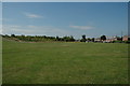
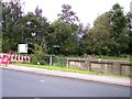
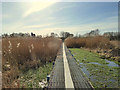
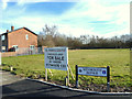
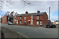
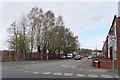
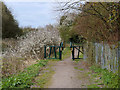
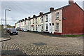
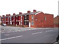
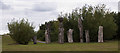
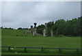
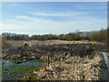
Parr Ward sits on the eastern side of St Helens in Merseyside, covering an area of 4.2 square kilometres. This historic township dates back to the 12th century and emerged from significant industrial development involving coal mining and chemical works. Although the 2011 census recorded a population of 12,199, current estimates suggest around 4,426 residents live within the ward today. The area's character is defined by its dense urban layout, blending early 20th-century industrial heritage with post-war social housing estates from the 1950s and 60s. Living in Parr Ward means engaging with a community shaped by its past. You will find yourself amidst developments like the Waring Avenue Estate and the Pennine Drive Estate, interspersed with private housing and original 1930s buildings. Regeneration projects since 2006, such as the Re:new Neighbourhood Management Project, have focused on improving local parks and green spaces, including the restoration of The Duckeries from a former slag heap. St Peter's Church, built between 1864 and 1865, stands as a physical landmark with distinctive three-coloured stone stonework. While the area industrial roots remain visible in districts colloquially known as "Cement City," the environment has evolved to support modern residential life. The median age of residents is notably high at 70, indicating a community with a distinct demographic profile compared to many other parts of England.
- Area Type
- District Borough Unitary Ward
- Area Size
- 4.2 km²
- Population
- 4426
- Population Density
- 1052 people/km²
Demographics
The community profile of Parr Ward shows a significant concentration of older residents. The median age is 70, which reflects a population heavily skewed towards later life. This high figure suggests that the area may appeal strongly to retirees or those seeking a quieter environment, although the specific distribution across different age brackets is not detailed in the available records. Of the total household composition within Parr Ward, 42% of residents own their homes outright or have a mortgage. This home ownership level sits below the national average, indicating a higher proportion of rental dwellings and social housing within the ward's boundaries. While exact breakdowns for religion and predominant ethnic groups are not specified in the provided information, the area's history points to a diverse tapestry of influences. Parr was historically part of the West Derby hundred district, yet its recent demographic trends highlight the importance of settling families and older generations in this shared space. The household statistics reveal a society where nearly half the population rents, a factor that influences local service demand and community cohesion. Understanding the age profile is crucial for anyone considering living in Parr Ward, as services and amenities often cater to the needs of an older demographic. The density of 1,052 people per square kilometre creates an urban atmosphere where neighbours are close at hand, fostering a form of local interdependence typical of established industrial townships.
Household Size
Accommodation Type
Tenure
Ethnic Group
Religion
Household Composition
Age
Household Deprivation
NS-SEC
Explore more demographic insights in this area
Go to Demographics tabPlanning
Planning Constraints
- Flood RiskLocked
- Ramsar Wetland SitesLocked
- Area of Outstanding Natural BeautyLocked
- Protected Nature ReserveLocked
- Protected WoodlandLocked
- Crime RiskLocked