Area Overview for Ormskirk West Ward
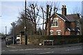
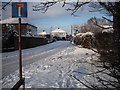
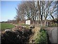
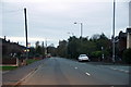
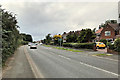
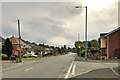
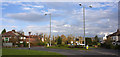
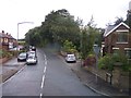
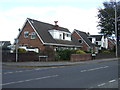
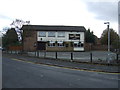
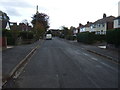
Photos of Ormskirk West Ward

Area Information
Ormskirk West Ward sits within the town of Ormskirk in the south-west of Lancashire, covering an area of 5.8 km². This district borough unitary ward accommodates a population of 1,459 residents, resulting in a density of 252 people per square kilometre. You are buying into a locale that functions as a local council ward under West Lancashire Borough Council. The area is centred approximately at coordinates 53.57745607477937, -2.8872988106938084, placing it firmly within a primarily rural borough. This rural character distinguishes the ward from its urban neighbours. To the east, Greater Manchester borders the area, while Merseyside lies to the south and west. Living in Ormskirk West Ward offers a specific geographic position within these wider administrative boundaries. You will find yourself in a defined political and geographic unit that bridges these larger regional divisions without taking on the high density of the cities themselves.
- Area Type
- District Borough Unitary Ward
- Area Size
- 5.8 km²
- Population
- 1459
- Population Density
- 252 people/km²
Demographics
The community profile of Ormskirk West Ward presents a distinct demographic picture. The median age for residents is 70 years. This aggregate age data indicates that the ward holds a population skew towards older age groups compared to the national average, which you should note before viewing homes in Ormskirk West Ward. Home ownership stands at 72% of households. This figure suggests a predominantly owned market rather than a privately rented one, which impacts how you might secure a property. The ward's household composition and predominant ethnic group statistics are noted in the available records, though the specific breakdowns are not detailed here. You can expect a community where residents have likely established long-term ties to the location. The prevailing age structure hints at a quieter pace of life where local services often cater to mature demographics. Understanding this age profile is essential for your daily experience living in this specific ward.
Household Size
Accommodation Type
Tenure
Ethnic Group
Religion
Household Composition
Age
Household Deprivation
NS-SEC
Explore more demographic insights in this area
Go to Demographics tabPlanning
Planning Constraints
- Flood RiskPremium
- Ramsar Wetland SitesPremium
- Area of Outstanding Natural BeautyPremium
- Protected Nature ReservePremium
- Protected WoodlandPremium
- Crime RiskPremium