Area Overview for Ormsgill and Parkside Ward
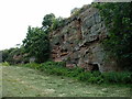
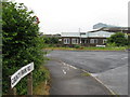
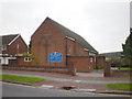
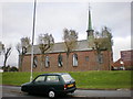
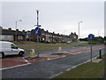
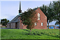
Photos of Ormsgill and Parkside Ward
Area Information
Ormsgill and Parkside Ward functions as a centralised electorial district within the Barrow-in-Furness area. This 5.7 km² locality serves as a key urban hub in North West England, housing 1,230 residents. The ward emerged in April 2023 following administrative restructuring under the Westmorland and Furness unitary authority. It replaced the former separate Ormsgill and Parkside wards that existed within the Barrow-in-Furness borough. The geography blends dense urban housing with green spaces. You find terraced and semi-detached properties lining the streets west of Abbey Road, which acts as a principal thoroughfare for the town. To the east, the landscape opens into Barrow Park, expansive fields, and parkland. This mix defines the daily rhythm of the neighbourhood. Residents navigate a setting where historic significance meets modern urban living. The area contains notable landmarks such as Furness Academy and several places of worship, including the Abbey Road Baptist Church and Trinity Church Centre. Living here means engaging with a compact community where residential density meets accessible open space. The ward coordinates roughly around 54.1362°N, 3.2272°W, placing it strategically between surrounding districts like Hindpool, Hawcoat, Newbarns, Risedale, and Roanhead. This central positioning offers residents immediate access to local amenities while maintaining proximity to the wider town centre. The boundary definitions and historical merger reflect a deliberate effort to create a cohesive residential unit within the larger metropolitan structure.
- Area Type
- District Borough Unitary Ward
- Area Size
- 5.7 km²
- Population
- 1230
- Population Density
- 214 people/km²
Demographics
The community inside Ormsgill and Parkside Ward displays a distinctly mature character. With a median age of 70 years, the population skews significantly older than the national average. This age profile suggests a suburb favoured by retirees or those seeking a quieter domestic environment. The ward consists of 1,230 people spread across the 5.7 km² footprint. Home ownership remains the dominant tenure model, with 68% of residents owning their homes outright or with a mortgage. This high ownership rate contrasts with areas where leasehold flats or rental accommodation dominate the market. Consequently, the area reflects long-term stability and deep community roots. About 35% of households consist of single people living alone, a figure that aligns with the older demographic profile. Half of the population identifies as Christian, reinforcing the traditional social fabric of the neighbourhood. Racial diversity is limited, with 96% of residents identifying as White British. This homogeneity is characteristic of many established Northern English towns. Health statistics indicate a positive outlook for inhabitants, as 90% of residents report being in fairly good to good health. This figure exceeds the broader Barrow-in-Furness average, suggesting a generally robust and fit older population. The ward captures a slice of life where stability and established social networks define the experience of local living.
Household Size
Accommodation Type
Tenure
Ethnic Group
Religion
Household Composition
Age
Household Deprivation
NS-SEC
Explore more demographic insights in this area
Go to Demographics tabPlanning
Planning Constraints
- Flood RiskPremium
- Ramsar Wetland SitesPremium
- Area of Outstanding Natural BeautyPremium
- Protected Nature ReservePremium
- Protected WoodlandPremium
- Crime RiskPremium