Area Overview for Old Trafford
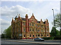
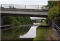
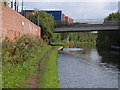
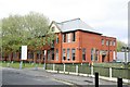
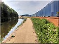
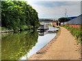
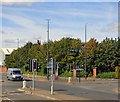
Photos of Old Trafford
Area Information
Living in Old Trafford means residing within a distinct built-up area of Manchester that has grown to cover 11.2 square kilometres. With a population of 5,270 residents, this neighbourhood maintains a relatively low population density of 471 people per square kilometre compared to the wider city. The location sits on the fringe of Manchester, offering a specific residential character separate from the Central Business District while remaining functionally connected to it. Daily life here is defined by proximity to major sporting landmarks and transport hubs, which shapes the commuter experience for many households. You will find a community that is residential by nature but deeply integrated with the city's infrastructure. The area's identity is closely tied to its name and its relationship with the surrounding municipal boundaries. Residents enjoy access to significant landmarks like the Imperial War Museum Village without being overwhelmed by high-density urban sprawl. This balance of space and connectivity makes Old Trafford a practical consideration for those seeking homes near city amenities but wanting a defined local environment. The neighbourhood supports a mix of housing needs, from families requiring school proximity to retirees seeking lower-density living arrangements. Understanding the specific layout of this 11.2 km² stretch is essential for anyone viewing properties here.
- Area Type
- Built Up Area 250
- Area Size
- 11.2 km²
- Population
- 5270
- Population Density
- 471 people/km²
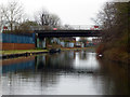
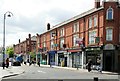
Residents of Old Trafford benefit from a wide array of amenities within practical reach of their homes. There are five Metro stations nearby, with notable options including the Imperial War Museum Village and Parkway, providing direct access to cultural and commercial centres. This connectivity means you can reach the museum or shopping districts quickly via the tram network. The area also boasts five railway stations, including Trafford Park Railway Station, Manchester United FC Railway Station, and Humphrey Park Railway Station. These rail links offer frequent services to Liverpool, Leeds, and London Station, reducing travel time significantly for commuting. For daily shopping needs, you have five major retail destinations to choose from. Co-op Salford, M&S Lowry, and Co-op Taylors are prominent locations for groceries and household essentials. Beyond shopping and transport, the Chorlton Street Coach Station provides long-distance travel flexibility, while Manchester City Airport offers private flight options from the vicinity. With five Metro points, five railheads, five retail clusters, one coach station, and one airport, the area functions as a comprehensive transport hub. This density of services ensures that major trips require minimal planning, as multiple modes of transport are available almost immediately upon leaving the front door.
Amenities
Schools
Families considering schools near Old Trafford have access to a mixed provision of educational institutions. Seymour Park Community Primary School holds an outstanding Ofsted rating, making it a primary choice for families seeking high academic standing. Kings Road Primary School also carries a good Ofsted rating, offering another robust option within the immediate catchment or commuting radius. Both primary options provide local education for younger children living in the area. Old Trafford is also home to several primary institutions that support the local community without current published Ofsted designations. Old Trafford Junior School, Old Trafford Infants' School, and Kings Road Primary School form a core group of state-funded education providers for the neighbourhood younger population. Beyond the primary sector, St John Vianney School serves a special educational needs role, offering tailored support for children with specific learning requirements. This school mix means you can find suitable schooling adjacent to your home or within a short travel distance. The presence of a special school ensures local care for vulnerable students, while the primary sector options cater to the standard curriculum needs of the majority. When planning a move, checking which specific school corresponds to your home address is vital, given the named provision in the area.
| Rank | School | Type | Entry gender | Ages |
|---|
Explore more schools in this area
Go to Schools tabDemographics
The community profile in Old Trafford presents a clear picture of an older demographic compared to the national average. The median age of residents is 70, indicating that this area attracts a later-life population or reflects longer-term retention of older homeowners. While the most common age range data aggregates the total population, the high median age suggests a neighbourhood with fewer young children relative to younger professionals. This demographic skew often influences local spending habits and the prevalence of leisure facilities suited to mature residents. Home ownership stands at 41% across the area, meaning nearly six out of ten households are renting their homes. This figure contrasts with many established English towns where ownership rates typically exceed 60%. The high proportion of social or private tenants suggests a significant intake of residents through social housing grants or private renting schemes. Accommodation types vary, but the low ownership rate is a primary statistical feature of the local housing stock. Household composition data confirms that the area is serviced by a wide array of household types, yet the age profile heavily weights the older end of the spectrum.
Household Size
Accommodation Type
Tenure
Ethnic Group
Religion
Household Composition
Age
Household Deprivation
NS-SEC
Explore more demographic insights in this area
Go to Demographics tabPlanning
Planning Constraints
- Crime RiskPremium