Area Overview for Old Swan East Ward
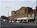
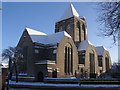
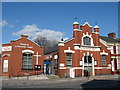
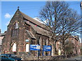
Photos of Old Swan East Ward

Area Information
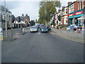
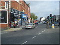
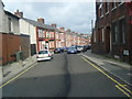
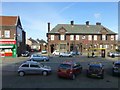
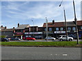
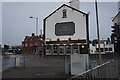
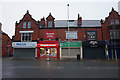
Old Swan East Ward is a defined district within the Liverpool City Council unitary authority, covering an area of 64.6 hectares. This specific electoral ward, designated as Ward No 39, forms the eastern portion of the wider Old Swan neighbourhood in Merseyside. The area is geographically anchored around the junction of Prescot Road, Derby Lane, St Oswald Street, and Broadgreen Road. Residents positioning themselves near these coordinates, approximately 53.4156°N, 2.9111°W, are situated in a location with deep historical roots. The name itself commemorates the Three Swans public house, which historically served the 18th-century pack-horse route that followed Prescot Road, now the A57. Population records from 2011 indicate about 6,202 residents calling this ward home across 2,817 households. You are looking at a compact residential zone with significant local infrastructure. The ward functions as a continuous community rather than a collection of isolated developments. Its current status depends on established boundaries rather than temporary planning areas.
- Area Type
- District Borough Unitary Ward
- Area Size
- 64.6 hectares
- Population
- Not available
- Population Density
- Not available
Demographics
The community profile in Old Swan East Ward reveals a mature population. The median age stands at 70 years, indicating that older residents form the largest demographic group. When evaluating who lives in Old Swan East Ward, you find a population that has settled into this specific ward for a considerable period. This age distribution typically influences local demand for services and social amenities. Home ownership is established, with 56% of properties occupied by their owners. This majority suggests a stable demographic where residents have invested in their homes over time. The ward comprises a specific number of households, recorded as 2,817 in the 2011 census. While the data highlights total household composition and accommodation statistics without breaking them down into single-person or family units, the high ownership rate points toward traditional family or independent living arrangements. You do not need to consider young, transient populations as the primary characteristic of this ward. Instead, you are looking at an area where a significant portion of the population has achieved or maintained long-term residency. The ethnic, religious, and specific age breakdowns beyond the total median are not detailed in the current figures, so you must rely on the overarching age statistic to understand the character of the neighbourhood.
Household Size
Accommodation Type
Tenure
Ethnic Group
Religion
Household Composition
Age
Household Deprivation
NS-SEC
Explore more demographic insights in this area
Go to Demographics tabPlanning
Planning Constraints
- Flood RiskPremium
- Ramsar Wetland SitesPremium
- Area of Outstanding Natural BeautyPremium
- Protected Nature ReservePremium
- Protected WoodlandPremium
- Crime RiskPremium