Area Overview for Old Hutton and Holmescales
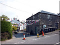
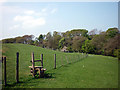
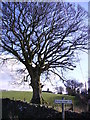
Photos of Old Hutton and Holmescales
Area Information
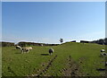
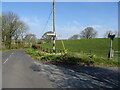
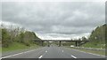
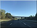
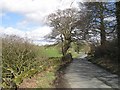
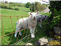
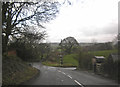
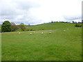
Old Hutton and Holmescales is a civil parish located in England, covering a total area of 16.1 km². Living in this settlement offers a distinct experience defined by its small scale and established character. The area functions as a typical rural parish where daily life revolves around local amenities and the immediate surroundings. You can expect a community that has remained relatively unchanged for decades, maintaining a pace slower than nearby urban centres. The landscape here supports residents who value quiet residences rather than metropolitan excitement. Your surroundings will consist of a mix of residential properties spread across the parish limits. The total space available means that development is likely low-density compared to towns. When you consider homes in Old Hutton and Holmescales, you are joining an area where the built environment is contained within a specific boundary. This parish status indicates a degree of local governance and community identity that persists despite changes over time. The location provides a stable environment for those seeking a predictable lifestyle. Life here is practical and grounded. You will not find entertainment districts within the immediate parish, but the layout supports a self-contained existence. The 16.1 km² footprint ensures that distances between homes are short enough to manage without heavy reliance on public transport. Residents enjoy a setting where the natural environment interacts closely with habitation. This combination of small area and civil parish status creates a defined community space. It is an environment suitable for those who prioritise stability and low population density.
- Area Type
- Parish
- Area Size
- 16.1 km²
- Population
- Not available
- Population Density
- Not available
Demographics
The community profile of Old Hutton and Holmescales presents a clear demographic reality. Living in this area means interacting with a population where the median age is 70 years. This figure indicates that older residents form the core of the community. You will find that the most common age range aligns with the total population data, suggesting a mature demographic spread across the parish. When you analyse household composition, the data reflects the needs of a population with a high life expectancy. Home ownership stands out as a defining feature of the local housing market. Exactly 85% of homes in Old Hutton and Holmescales are owned by their occupants. This high rate signifies a long-term community where residents have established roots rather than transient populations. The remaining 15% consist of rented accommodation, though the scale is significantly smaller than in urban areas. You will not encounter frequent turnover of tenants in this parish. The stability of home ownership influences how people engage with neighbourhood initiatives. Accommodation types and household structures reflect this older population profile. Families with young children are less likely to be the dominant group compared to the median age suggests. Ethnic diversity and religious adherence data are recorded for the total population, but the dominant groups align with the area's historical settlement patterns. There is no indication of rapid demographic shifts occurring within the parish boundaries. The community remains consistent with its 70-year median age. You should expect a neighbourhood where neighbours know each other well because they have lived there for many years.
Household Size
Accommodation Type
Tenure
Ethnic Group
Religion
Household Composition
Age
Household Deprivation
NS-SEC
Explore more demographic insights in this area
Go to Demographics tabPlanning
Planning Constraints
- Flood RiskPremium
- Ramsar Wetland SitesPremium
- Area of Outstanding Natural BeautyPremium
- Protected Nature ReservePremium
- Protected WoodlandPremium
- Crime RiskPremium