Area Overview for OL9 7RW
Photos of OL9 7RW
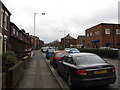
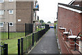
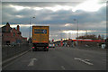
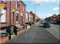
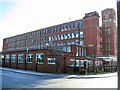
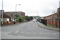
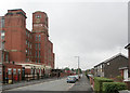
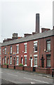
59 photos from this area
Area Information
Key information about the OL9 7RW including its size, population, and administrative classification.
- Area Type
- Postcode
- Area Size
- 1901 m²
- Population
- 2705
- Population Density
- 12346 people/km²
House Prices in OL9 7RW
12
Properties
£39,455
Average Sold Price
£727
Lowest Price
£99,000
Highest Price
Showing 12 properties
| Address | Type | Beds | Baths | Last Sale Price | Last Sale Date | |
|---|---|---|---|---|---|---|
| 66 Lincoln Street, Oldham, OL9 7RW | house | - | - | £30,000 | Jan 2025 | |
| 71 Lincoln Street, Oldham, OL9 7RW | Terraced | 2 | 1 | £727 | Nov 2019 | |
| 74 Lincoln Street, Oldham, OL9 7RW | house | - | - | £58,000 | Jul 2018 | |
| 69 Lincoln Street, Oldham, OL9 7RW | house | - | - | £99,000 | Aug 2017 | |
| 70 Lincoln Street, Oldham, OL9 7RW | house | - | - | £30,000 | Jan 2004 | |
| 79 Lincoln Street, Oldham, OL9 7RW | house | - | - | £19,000 | Dec 2003 | |
| 75 Lincoln Street, Oldham, OL9 7RW | Terraced | 2 | 1 | - | - | |
| 73 Lincoln Street, Oldham, OL9 7RW | house | - | - | - | - | |
| 77 Lincoln Street, Oldham, OL9 7RW | house | - | - | - | - | |
| 72 Lincoln Street, Oldham, OL9 7RW | house | - | - | - | - |
Page 1 of 2
Energy Efficiency in OL9 7RW
Amenities
Schools
| Rank | School | Type | Entry gender | Ages |
|---|
Explore more schools in this area
Go to Schools tabDemographics
Household Size
Family (3-5 people)
most common
Accommodation Type
Houses
most common
Tenure
55
majority
Ethnic Group
asian_total
most common
Religion
N/A
most common
Household Composition
N/A
most common
Age
22
median
Adults (30-64 years)
most common
Household Deprivation
N/A
with no deprivation
NS-SEC
10
in Lower managerial occupations
Explore more demographic insights in this area
Go to Demographics tabPlanning
Planning Constraints
- Flood RiskPremium
- Ramsar Wetland SitesPremium
- Area of Outstanding Natural BeautyPremium
- Protected Nature ReservePremium
- Protected WoodlandPremium