Area Overview for OL9 7EP
Photos of OL9 7EP
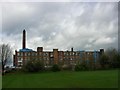
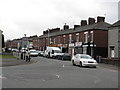
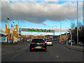
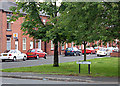
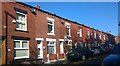
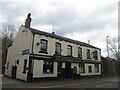
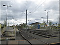
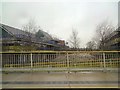
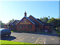
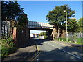
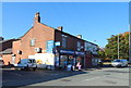
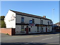
39 photos from this area
Area Information
Key information about the OL9 7EP including its size, population, and administrative classification.
- Area Type
- Postcode
- Area Size
- 2330 m²
- Population
- 1913
- Population Density
- 7249 people/km²
House Prices in OL9 7EP
18
Properties
£80,476
Average Sold Price
£30,000
Lowest Price
£155,000
Highest Price
Showing 18 properties
| Address | Type | Beds | Baths | Last Sale Price | Last Sale Date | |
|---|---|---|---|---|---|---|
| 38 Albert Street, Chadderton, OL9 7EP | Terraced | 2 | 1 | £142,000 | Sep 2023 | |
| 10 Albert Street, Chadderton, OL9 7EP | house | - | - | £122,000 | Dec 2022 | |
| 22 Albert Street, Chadderton, OL9 7EP | house | - | - | £135,000 | May 2022 | |
| 42 Albert Street, Chadderton, OL9 7EP | house | - | - | £155,000 | Apr 2022 | |
| 26 Albert Street, Chadderton, OL9 7EP | Terraced | 2 | 1 | £75,000 | Dec 2020 | |
| 30 Albert Street, Chadderton, OL9 7EP | Terraced | 2 | 1 | £65,000 | Aug 2020 | |
| 16 Albert Street, Chadderton, OL9 7EP | house | - | - | £63,615 | Jul 2019 | |
| 32 Albert Street, Chadderton, OL9 7EP | house | - | - | £67,000 | Jan 2017 | |
| 40 Albert Street, Chadderton, OL9 7EP | house | 2 | - | £76,000 | May 2015 | |
| 34 Albert Street, Chadderton, OL9 7EP | house | - | - | £41,000 | Apr 2015 |
Page 1 of 2
Energy Efficiency in OL9 7EP
Amenities
Schools
| Rank | School | Type | Entry gender | Ages |
|---|
Explore more schools in this area
Go to Schools tabDemographics
Household Size
Family (3-5 people)
most common
Accommodation Type
Houses
most common
Tenure
43
majority
Ethnic Group
White
most common
Religion
N/A
most common
Household Composition
N/A
most common
Age
47
median
Adults (30-64 years)
most common
Household Deprivation
N/A
with no deprivation
NS-SEC
19
in Lower managerial occupations
Explore more demographic insights in this area
Go to Demographics tabPlanning
Planning Constraints
- Flood RiskPremium
- Ramsar Wetland SitesPremium
- Area of Outstanding Natural BeautyPremium
- Protected Nature ReservePremium
- Protected WoodlandPremium