Area Overview for OL8 4JE
Photos of OL8 4JE

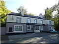
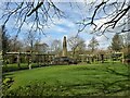
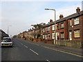
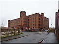
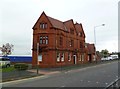
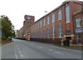
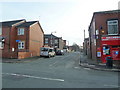
49 photos from this area
Area Information
Key information about the OL8 4JE including its size, population, and administrative classification.
- Area Type
- Postcode
- Area Size
- 9606 m²
- Population
- 1827
- Population Density
- 8200 people/km²
House Prices in OL8 4JE
44
Properties
£87,925
Average Sold Price
£710
Lowest Price
£151,500
Highest Price
Showing 44 properties
| Address | Type | Beds | Baths | Last Sale Price | Last Sale Date | |
|---|---|---|---|---|---|---|
| 19 Merton Avenue, Oldham, OL8 4JE | house | - | - | £133,000 | Mar 2025 | |
| 8 Merton Avenue, Oldham, OL8 4JE | Terraced | 2 | 1 | £151,500 | Feb 2023 | |
| 12 Merton Avenue, Oldham, OL8 4JE | house | - | - | £125,000 | Jan 2023 | |
| 42 Merton Avenue, Oldham, OL8 4JE | Retail | 3 | 1 | £135,000 | Jun 2022 | |
| 44 Merton Avenue, Oldham, OL8 4JE | house | - | - | £115,000 | Feb 2022 | |
| 20 Merton Avenue, Oldham, OL8 4JE | house | - | - | £150,000 | Aug 2021 | |
| 34 Merton Avenue, Oldham, OL8 4JE | house | - | - | £120,000 | Jun 2021 | |
| 13 Merton Avenue, Oldham, OL8 4JE | Semi-detached | 3 | 1 | £135,000 | Feb 2021 | |
| 32 Merton Avenue, Oldham, OL8 4JE | house | - | - | £710 | Dec 2020 | |
| 48 Merton Avenue, Oldham, OL8 4JE | Semi-detached | 2 | - | £110,000 | Dec 2019 |
Page 1 of 5
Energy Efficiency in OL8 4JE
Amenities
Schools
| Rank | School | Type | Entry gender | Ages |
|---|
Explore more schools in this area
Go to Schools tabDemographics
Household Size
Family (3-5 people)
most common
Accommodation Type
Houses
most common
Tenure
79
majority
Ethnic Group
asian_total
most common
Religion
N/A
most common
Household Composition
N/A
most common
Age
47
median
Adults (30-64 years)
most common
Household Deprivation
N/A
with no deprivation
NS-SEC
22
in Lower managerial occupations
Explore more demographic insights in this area
Go to Demographics tabPlanning
Planning Constraints
- Flood RiskPremium
- Ramsar Wetland SitesPremium
- Area of Outstanding Natural BeautyPremium
- Protected Nature ReservePremium
- Protected WoodlandPremium