Area Overview for OL8 4HG
Photos of OL8 4HG


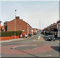
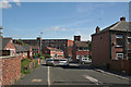
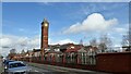
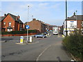
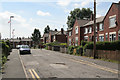

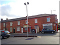
37 photos from this area
Area Information
Key information about the OL8 4HG including its size, population, and administrative classification.
- Area Type
- Postcode
- Area Size
- 1.8 hectares
- Population
- 1827
- Population Density
- 8200 people/km²
House Prices in OL8 4HG
45
Properties
£129,583
Average Sold Price
£35,000
Lowest Price
£335,000
Highest Price
Showing 45 properties
| Address | Type | Beds | Baths | Last Sale Price | Last Sale Date | |
|---|---|---|---|---|---|---|
| 280 Frederick Street, Oldham, OL8 4HG | house | - | - | £235,000 | Mar 2024 | |
| 252 Frederick Street, Oldham, OL8 4HG | house | - | - | £265,000 | Dec 2022 | |
| 315 Frederick Street, Oldham, OL8 4HG | house | - | - | £335,000 | Jun 2022 | |
| 264 Frederick Street, Oldham, OL8 4HG | Semi-detached | 3 | 1 | £130,000 | Dec 2021 | |
| 274 Frederick Street, Oldham, OL8 4HG | house | - | - | £145,000 | Dec 2020 | |
| 323 Frederick Street, Oldham, OL8 4HG | house | - | - | £220,000 | Aug 2019 | |
| 246 Frederick Street, Oldham, OL8 4HG | Terraced | 4 | 1 | £178,000 | Jun 2019 | |
| 262 Frederick Street, Oldham, OL8 4HG | house | - | - | £165,000 | Feb 2019 | |
| 333 Frederick Street, Oldham, OL8 4HG | Detached | 4 | 3 | £280,000 | Apr 2017 | |
| 276 Frederick Street, Oldham, OL8 4HG | Terraced | 3 | 1 | £112,500 | Jun 2015 |
Page 1 of 5
Energy Efficiency in OL8 4HG
Amenities
Schools
| Rank | School | Type | Entry gender | Ages |
|---|
Explore more schools in this area
Go to Schools tabDemographics
Household Size
Family (3-5 people)
most common
Accommodation Type
Houses
most common
Tenure
79
majority
Ethnic Group
asian_total
most common
Religion
N/A
most common
Household Composition
N/A
most common
Age
47
median
Adults (30-64 years)
most common
Household Deprivation
N/A
with no deprivation
NS-SEC
22
in Lower managerial occupations
Explore more demographic insights in this area
Go to Demographics tabPlanning
Planning Constraints
- Flood RiskPremium
- Ramsar Wetland SitesPremium
- Area of Outstanding Natural BeautyPremium
- Protected Nature ReservePremium
- Protected WoodlandPremium