Area Overview for OL7 9TJ
Photos of OL7 9TJ
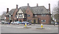

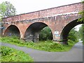
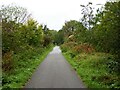
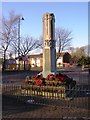
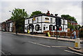
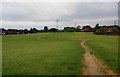
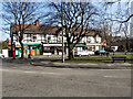
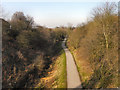
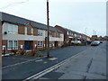
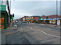
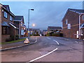
40 photos from this area
Area Information
Key information about the OL7 9TJ including its size, population, and administrative classification.
- Area Type
- Postcode
- Area Size
- 5397 m²
- Population
- 1496
- Population Density
- 3542 people/km²
House Prices in OL7 9TJ
15
Properties
£184,411
Average Sold Price
£82,950
Lowest Price
£445,000
Highest Price
Showing 15 properties
| Address | Type | Beds | Baths | Last Sale Price | Last Sale Date | |
|---|---|---|---|---|---|---|
| 14 Spring Clough, Ashton Under Lyne, OL7 9TJ | Semi-detached | 3 | 1 | £245,000 | Feb 2025 | |
| 6 Spring Clough, Ashton Under Lyne, OL7 9TJ | house | - | - | £445,000 | Jan 2023 | |
| 5 Spring Clough, Ashton Under Lyne, OL7 9TJ | Flat | - | - | £129,000 | Sep 2020 | |
| 8 Spring Clough, Ashton Under Lyne, OL7 9TJ | Detached | 4 | - | £242,000 | Jan 2017 | |
| 16 Spring Clough, Ashton Under Lyne, OL7 9TJ | house | - | - | £153,000 | Oct 2014 | |
| 7 Spring Clough, Ashton Under Lyne, OL7 9TJ | Flat | - | - | £121,500 | Jul 2014 | |
| 12 Spring Clough, Ashton Under Lyne, OL7 9TJ | Semi-detached | 3 | - | £146,000 | Jun 2014 | |
| 9 Spring Clough, Ashton Under Lyne, OL7 9TJ | house | 4 | - | £205,000 | Oct 2011 | |
| 3 Spring Clough, Ashton Under Lyne, OL7 9TJ | Maisonette | - | - | £118,500 | Jul 2006 | |
| 4 Spring Clough, Ashton Under Lyne, OL7 9TJ | Detached | - | - | £195,950 | Dec 2003 |
Page 1 of 2
Energy Efficiency in OL7 9TJ
Amenities
Schools
| Rank | School | Type | Entry gender | Ages |
|---|
Explore more schools in this area
Go to Schools tabDemographics
Household Size
One person
most common
Accommodation Type
Houses
most common
Tenure
48
majority
Ethnic Group
White
most common
Religion
N/A
most common
Household Composition
N/A
most common
Age
47
median
Adults (30-64 years)
most common
Household Deprivation
N/A
with no deprivation
NS-SEC
20
in Lower managerial occupations
Explore more demographic insights in this area
Go to Demographics tabPlanning
Planning Constraints
- Flood RiskPremium
- Ramsar Wetland SitesPremium
- Area of Outstanding Natural BeautyPremium
- Protected Nature ReservePremium
- Protected WoodlandPremium