Area Overview for OL7 9PU
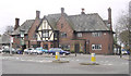
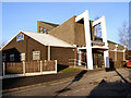
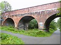
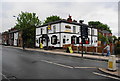
Photos of OL7 9PU


Area Information
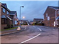
Living in OL7 9PU offers a specific residential experience centred on a tightly defined cluster. This postcode covers an area of just 6104 square metres, creating a very compact living environment for its residents. Currently, 1746 people call this small location home. The density here is significant, with 286042 people per square kilometre, which means daily interactions are likely frequent despite the limited physical space. You will find a neighbourhood where boundaries are clear and the community feels immediate. The postcode designation acts as the primary identifier for this distinct pocket of settlement within the wider region. Everyone in this area shares the same immediate surroundings, from the local streets to the nearby access points. The simplicity of the layout ensures that the daily commute or evening walk covers only a short distance. Yet, the small area belies the character of the community within. It is a place defined by its scale rather than sprawling landscapes. Residents navigate a space where proximity to amenities and neighbours is maximised within this constrained footprint.
- Area Type
- Postcode
- Area Size
- 6104 m²
- Population
- 1746
- Population Density
- 8028 people/km²
The property market in OL7 9PU is dominated by houses, as shown by the accommodation type data. Only 41% of the population are homeowners, which indicates that the rental market accounts for the majority of households. This high proportion of renters suggests a dynamic environment where tenants may move more frequently than in owner-occupied estates. The predominant accommodation type is houses, meaning that buyers looking for traditional family housing will find this postcode suitable. However, the higher rental rate implies that landlords or investment groups also have a significant presence. When you buy a home in OL7 9PU, you are entering a potentially competitive market where availability could vary. The small area size of 6104 square metres constrains the total supply of properties available on the open market. There is no data provided on average property prices or sale velocity, so current valuation metrics remain unspecified. The distinction between owner-occupied and rental stock here is more pronounced than in larger suburban zones. You must consider both the immediate scarcity of units and the competitive nature of the tenure split.
House Prices in OL7 9PU
Showing 18 properties
| Address | Type | Beds | Baths | Last Sale Price | Last Sale Date | |
|---|---|---|---|---|---|---|
| 8 Sheldon Court, Ashton Under Lyne, OL7 9PU | Flat | - | - | - | - | |
| 2 Sheldon Court, Ashton Under Lyne, OL7 9PU | Flat | - | - | - | - | |
| 18 Sheldon Court, Ashton Under Lyne, OL7 9PU | Flat | - | - | - | - | |
| 19 Sheldon Court, Ashton Under Lyne, OL7 9PU | Flat | - | - | - | - | |
| 4 Sheldon Court, Ashton Under Lyne, OL7 9PU | Flat | - | - | - | - | |
| 1 Sheldon Court, Ashton Under Lyne, OL7 9PU | Flat | - | - | - | - | |
| 3 Sheldon Court, Ashton Under Lyne, OL7 9PU | Flat | - | - | - | - | |
| 7 Sheldon Court, Ashton Under Lyne, OL7 9PU | Flat | - | - | - | - | |
| 10 Sheldon Court, Ashton Under Lyne, OL7 9PU | Flat | - | - | - | - | |
| 17 Sheldon Court, Ashton Under Lyne, OL7 9PU | Flat | - | - | - | - |
Energy Efficiency in OL7 9PU
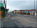
Residents of OL7 9PU have access to a variety of amenities within practical reach. Retail options include Farmfoods Waterloo, Aldi Ashton, and Tesco Ashton Under Lyne, ensuring that daily shopping needs are met without leaving the immediate region. Rail travel is facilitated by nearby Ashton, Stalybridge Railway Station, and Guide Bridge Railway Station, offering connections beyond the local area. Metro services are also available through Ashton West, Ashton Moss, and Audenshaw stops, providing additional flexibility for commuters. A bus station operates at Chorlton Street Coach Station, adding another layer of public transport capability. You will find retail, rail, and metro options clustered close enough for convenient daily use. These facilities support everything from quick grocery runs to longer journeys for leisure or work. The mix of supermarkets ensures that household shopping is handled efficiently. Transport hubs allow you to leave the area easily when necessary. The accessibility of these named venues defines the lifestyle convenience you can expect in this postcode.
Amenities
Schools
Canon Johnson CofE Primary School serves the educational needs of children living in OL7 9PU. It is classified as a primary school and holds an Ofsted rating of good. This singular institution forms the backbone of formal education for younger residents in the immediate vicinity. Because this is a small residential cluster, local families often rely on this one accessible option for primary schooling. The school offers a specific religious foundation as indicated by its CofE designation. No secondary schools are listed in the data for this postcode, meaning older children likely travel further or join faith-based institutions elsewhere. The presence of a school with a good rating provides reassurance for parents concerned about educational standards. You should factor in transport links to the school when viewing homes in OL7 9PU. The proximity ensures a short commute for pupils and parents alike. This single-school environment simplifies the education decision for new families settling in the area.
| Rank | School | Type | Entry gender | Ages |
|---|
Explore more schools in this area
Go to Schools tabDemographics
The community in OL7 9PU reflects a mature demographic profile, with a median age of 47 years. Adults between the ages of 30 and 64 years represent the most common age range, indicating that working-age families often make up the core of the neighbourhood. Home ownership stands at 41%, meaning that more than half of the households rent their accommodation. The predominant ethnic group recorded in this postcode is White, reflecting the established composition of the local population. Residents primarily live in houses rather than flats or other apartment styles. This housing preference aligns with the area's character as a residential cluster. The data shows a stable adult population with a higher rate of renting compared to ownership. This balance suggests a diverse mix of tenure types despite the clear preference for detached or semi-detached dwellings. The age distribution points to a neighbourhood where former young adults have settled or where long-term residents remain. There is no data available on deprivation levels or income extremes within the provided statistics, so any discussion of economic disparity is currently unsupported. The population figures provide a clear picture of who currently resides in this area.
Household Size
Accommodation Type
Tenure
Ethnic Group
Religion
Household Composition
Age
Household Deprivation
NS-SEC
Explore more demographic insights in this area
Go to Demographics tabPlanning
Planning Constraints
- Flood RiskPremium
- Ramsar Wetland SitesPremium
- Area of Outstanding Natural BeautyPremium
- Protected Nature ReservePremium
- Protected WoodlandPremium