Area Overview for OL7 0PG
Photos of OL7 0PG

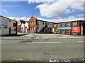
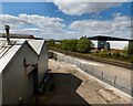
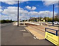
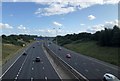
56 photos from this area
Area Information
Key information about the OL7 0PG including its size, population, and administrative classification.
- Area Type
- Postcode
- Area Size
- 8.9 hectares
- Population
- 2175
- Population Density
- 2825 people/km²
House Prices in OL7 0PG
12
Properties
-
Average Sold Price
-
Lowest Price
-
Highest Price
Showing 12 properties
| Address | Type | Beds | Baths | Last Sale Price | Last Sale Date | |
|---|---|---|---|---|---|---|
| Flat 2, The Ashton Moss Ph, Fold Way, Ashton Under Lyne, OL7 0PG | Flat | - | - | - | - | |
| Flat 3, The Ashton Moss Ph, Fold Way, Ashton Under Lyne, OL7 0PG | restaurant_cafe | - | - | - | - | |
| Flat 1, The Ashton Moss Ph, Fold Way, Ashton Under Lyne, OL7 0PG | restaurant_cafe | - | - | - | - | |
| Tgi Fridays, Fold Way, Ashton Under Lyne, OL7 0PG | restaurant_cafe | - | - | - | - | |
| Unit B, B2, Fold Way, Ashton Under Lyne, OL7 0PG | restaurant_cafe | - | - | - | - | |
| Unit A, B2, Fold Way, Ashton Under Lyne, OL7 0PG | assembly_leisure | - | - | - | - | |
| The Ashton Moss Ph, Fold Way, Ashton Under Lyne, OL7 0PG | Leisure | - | - | - | - | |
| Kfc Restaurant, Fold Way, Ashton Under Lyne, OL7 0PG | Retail | - | - | - | - | |
| Nandos Restaurant, Fold Way, Ashton Under Lyne, OL7 0PG | Retail | - | - | - | - | |
| Frankie And Bennys Restaurant, Fold Way, Ashton Under Lyne, OL7 0PG | Retail | - | - | - | - |
Page 1 of 2
Energy Efficiency in OL7 0PG
Amenities
Schools
| Rank | School | Type | Entry gender | Ages |
|---|
Explore more schools in this area
Go to Schools tabDemographics
Household Size
Family (3-5 people)
most common
Accommodation Type
Houses
most common
Tenure
50
majority
Ethnic Group
asian_total
most common
Religion
N/A
most common
Household Composition
N/A
most common
Age
22
median
Adults (30-64 years)
most common
Household Deprivation
N/A
with no deprivation
NS-SEC
13
in Lower managerial occupations
Explore more demographic insights in this area
Go to Demographics tabPlanning
Planning Constraints
- Flood RiskPremium
- Ramsar Wetland SitesPremium
- Area of Outstanding Natural BeautyPremium
- Protected Nature ReservePremium
- Protected WoodlandPremium