Area Overview for OL7 0FT
Photos of OL7 0FT


Area Information
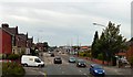
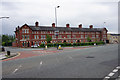
The postcode OL7 0FT represents a small residential cluster in England, covering an area of just 1557 square metres. The total population stands at 2297 residents, creating an environment that feels intimate despite its urban location within the Greater Manchester region. You live in a defined part of Ashton, where daily life revolves around a compact community structure. The area functions as a tight-knit residential node rather than a sprawling neighbourhood. Prospective buyers should understand that OL7 0FT is characterised by its density and proximity to major transport arteries. The small physical footprint means that local facilities are often within immediate walking distance. Living here offers a specific type of convenience where your neighbours and local shops are close at hand. The area serves as a practical base for commuters and families who prioritise location over expansive gardens or long walks through the countryside. Your experience of the area will be shaped by its role as a connector between Ashton and surrounding districts.
- Area Type
- Postcode
- Area Size
- 1557 m²
- Population
- 2297
- Population Density
- 9492 people/km²
The property market in OL7 0FT is characterised by a residential cluster dominated by houses. Currently, 35% of the dwellings are owned outright or with a mortgage. The remainder consists of rented accommodation or other housing tenure types. This split indicates a mixed market where both investors and owner-occupiers are present. The primary accommodation type is houses, meaning you are unlikely to find high-rise apartment living within this specific postcode. Buyers looking for bungalows, semi-detached, or detached homes will find the existing stock aligns with these preferences. The area serves as a small-scale node within the broader Ashton property landscape. Prospective buyers should consider that the limited size of 1557 square metres means the housing supply is constrained. Competition for properties may be higher into areas like nearby Ashton Moss or Audenshaw if stock is tight. The ownership rate suggests a established market rather than a volatile investor-driven zone.
House Prices in OL7 0FT
Showing 12 properties
Energy Efficiency in OL7 0FT
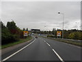
Living in OL7 0FT provides convenient access to a range of retail and transport hubs. You have 5 notable retail options within practical reach, including Lidl Central Ashton, Asda Ashton, and M&S Ashton. These supermarkets ensure you can handle weekly shopping without travelling far. Public transport is well supported with 5 nearby Metro stops including Ashton West, Ashton Moss, and Audenshaw. There are also 5 railway stations in close proximity, such as Ashton and Guide Bridge Railway Station. One major bus facility, Chorlton Street Coach Station, serves the local network. This layout provides flexibility for those who rely on public transport for their daily commute. Residents can walk to essential services quickly. The concentration of amenities supports a self-sufficient lifestyle where you do not need to travel deep into Manchester city centre for basic needs. Dining and leisure opportunities are supported by these nearby high streets and transport interchanges.
Amenities
Schools
| Rank | School | Type | Entry gender | Ages |
|---|
Explore more schools in this area
Go to Schools tabDemographics
The community in OL7 0FT is defined by a mature demographic profile with a median age of 47 years. You will find that the most common age range consists of adults between 30 and 64 years. This indicates a neighbourhood dominated by established workers and families rather than young professionals or retirees. Over 35% of residents in OL7 0FT are homeowners, suggesting a degree of financial stability within the cluster. The majority of the housing stock comprises houses, which aligns with the preference for family-oriented living. The predominant ethnic group is White, reflecting the traditional character of the Ashton neighbourhood. When evaluating quality of life, the age distribution suggests a community with generational ties to the local area. Young families often find stability here alongside long-term residents who have built significant roots. The high proportion of homeowners indicates a level of security investment in the area.
Household Size
Accommodation Type
Tenure
Ethnic Group
Religion
Household Composition
Age
Household Deprivation
NS-SEC
Explore more demographic insights in this area
Go to Demographics tabPlanning
Planning Constraints
- Flood RiskPremium
- Ramsar Wetland SitesPremium
- Area of Outstanding Natural BeautyPremium
- Protected Nature ReservePremium
- Protected WoodlandPremium