Area Overview for OL6 9PH
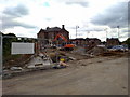
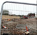
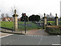
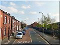
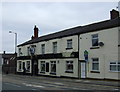
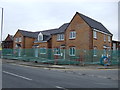
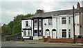
Photos of OL6 9PH


Area Information
Living in OL6 9PH offers a distinct residential experience within a small cluster that spans approximately 2,551 square metres. You will find that nearly 1,900 people call this postcode home, creating a tightly knit neighbourhood with high demand for available space. The population density reaches 738,392 people per square kilometre, indicating a very compact living environment where amenities are close at hand. This specific postcode captures a slice of life in the greater Ashton-under-Lyne area, blending local convenience with proximity to wider transport links. Residents benefit from locations that serve as practical bases for families and commuters alike. The area stands apart due to its concentrated nature, ensuring that daily necessities are within a short walk or drive. You are stepping into a well-defined spot on the map rather than a sprawling suburb. The sheer number of people living on such a small footprint suggests a lively street scene and active community interaction. For those considering homes in OL6 9PH, the compact size means you are never far from where you need to be. It is a setting where neighbours are likely aware of local events and community news. This density fosters a sense of familiarity that characterises much of Greater Manchester's residential fabric.
- Area Type
- Postcode
- Area Size
- 2551 m²
- Population
- 1884
- Population Density
- 6650 people/km²
The property market in OL6 9PH is defined by its exclusivity to houses, as the accommodation data lists houses as the sole type of dwelling. This lack of flat options means buyers seeking terraced or semi-detached homes will find their requirements met here. With only 39% home ownership rates, a significant portion of the stock is on the rental ladder, making the area attractive to those seeking flexibility over security. You will find that this postcode covers a very specific residential cluster rather than a broad stretch of addresses. The small total area of 2,551 square metres combined with a population of 1,884 indicates that property values may be driven by scarcity of available land. Buyers looking at homes in OL6 9PH should understand that competition could intensify as the local supply is physically limited. The absence of flats removes the need to navigate different building eras or leasehold complexities common in Manchester city centre or Salford Quays. Instead, the market focuses on traditional family housing suitable for the demographic of adults aged 30 to 64. Given the high population density, street parking availability might be a practical concern for house owners. The mix indicates an area where people have chosen stability, despite the slightly lower ownership percentage compared to more affluent suburbs. This snapshot paints a picture of a market where housing is a commodity in short supply.
House Prices in OL6 9PH
Showing 14 properties
| Address | Type | Beds | Baths | Last Sale Price | Last Sale Date | |
|---|---|---|---|---|---|---|
| 79 Whiteacre Road, Ashton Under Lyne, OL6 9PH | house | - | - | £149,500 | Dec 2022 | |
| 55 Whiteacre Road, Ashton Under Lyne, OL6 9PH | house | - | - | £146,000 | Aug 2021 | |
| 81 Whiteacre Road, Ashton Under Lyne, OL6 9PH | house | - | - | £70,000 | Sep 2018 | |
| 51 Whiteacre Road, Ashton Under Lyne, OL6 9PH | Terraced | 2 | 1 | £47,000 | Apr 2015 | |
| 73 Whiteacre Road, Ashton Under Lyne, OL6 9PH | house | - | - | £73,000 | Oct 2014 | |
| 59 Whiteacre Road, Ashton Under Lyne, OL6 9PH | house | - | - | £114,000 | Oct 2009 | |
| 69 Whiteacre Road, Ashton Under Lyne, OL6 9PH | house | - | - | £60,000 | Apr 2009 | |
| 57 Whiteacre Road, Ashton Under Lyne, OL6 9PH | Terraced | 4 | 1 | £77,000 | Apr 2008 | |
| 75 Whiteacre Road, Ashton Under Lyne, OL6 9PH | Terraced | - | - | - | - | |
| 77 Whiteacre Road, Ashton Under Lyne, OL6 9PH | Terraced | - | - | - | - |
Energy Efficiency in OL6 9PH
Your daily life in OL6 9PH benefits from a strong array of retail and transport options within practical reach. You can visit Tesco Mossley, Iceland Ashton, or Heron Ashton for your weekly grocery and household shopping needs. These five retail venues ensure you are never dependent on a small corner shop for essentials. For long-distance travel, five rail stations including Ashton and Stalybridge offer direct connections to major cities. Additionally, five metro stops such as Ashton West and Audenshaw provide rapid transit links across the region. This density of amenities means you can manage household logistics without undertaking lengthy journeys. The presence of specific named venues like Heron Ashton adds a local touch to your routine, distinguishing it from generic high streets. While the area is residential, the commercial footprint nearby ensures that work, play, and rest remain accessible. You will notice that errands are planned around the availability of these five key service points rather than distant shopping centres. This accessibility supports a balanced lifestyle where time spent commuting to the shop or station is minimised. Residents appreciate knowing exactly where to go for a quick stop between school runs or office hours.
Amenities
Schools
Education near OL6 9PH is well supported by a cluster of primary schools, with options ranging from nursery to GCSE-preparatory age. The Heys Primary School holds a 'good' Ofsted rating, providing a validated standard of education for families settling in the area. You also have access to Parochial CofE Primary and Nursery School, Ashton-under-Lyne, which caters to those seeking a Church of England curriculum. St James CofE Primary School, Ashton-under-Lyne, and St Mary's RC Primary School offer Catholic and Church of England alternatives respectively. Whiteacre Nursery School is available for the youngest children, ensuring a seamless transition from early years into primary education. This concentration of schools means you do not need to commute far to secure schooling for your children. The mix of denominational schools allows you to align a home purchase with your educational values without moving further afield. All listed institutions are primary or nursery level, suggesting that secondary school catchment areas for this postcode may extend to neighbouring towns. For residents of OL6 9PH, the proximity of these named schools makes daily drop-offs manageable. The presence of multiple providers also gives families leverage when comparing transport routes and intake policies.
| Rank | School | Type | Entry gender | Ages |
|---|
Explore more schools in this area
Go to Schools tabDemographics
The community in OL6 9PH displays a mature profile, with a median age of 47 years for residents. The data confirms that adults aged between 30 and 64 years form the most common age range within this cluster. This demographic skew suggests the area attracts middle-aged professionals and parents who have settled in the region. Approximately 39% of households have achieved home ownership, a figure that sits slightly below the national average but reflects a stable residential population. The remaining six-in-decaires likely reside in rental accommodation, pointing to a mix of owner-occupiers and tenants. All accommodation within OL6 9PH consists of houses; there are no flats or apartments recorded for this specific postcode. The predominant ethnic group is White, which aligns with the broader historical settlement patterns of Tameside and surrounding towns. You should expect a community where long-term residents play a significant role in local affairs. The stability of the age group often leads to peaceful streets, though you must remain aware of security risks. With nearly half the population being school-age children or empty-nesters, the social fabric revolves around family life and local services. No data suggests a significant influx of younger singles seeking shared housing in this specific pocket, reinforcing its character as a family-oriented zone.
Household Size
Accommodation Type
Tenure
Ethnic Group
Religion
Household Composition
Age
Household Deprivation
NS-SEC
Explore more demographic insights in this area
Go to Demographics tabPlanning
Planning Constraints
- Flood RiskPremium
- Ramsar Wetland SitesPremium
- Area of Outstanding Natural BeautyPremium
- Protected Nature ReservePremium
- Protected WoodlandPremium