Area Overview for OL6 9EY
Photos of OL6 9EY
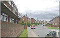
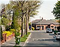
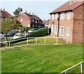
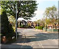
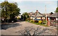
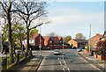
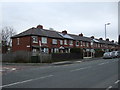
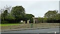
36 photos from this area
Area Information
Key information about the OL6 9EY including its size, population, and administrative classification.
- Area Type
- Postcode
- Area Size
- 7150 m²
- Population
- 1516
- Population Density
- 4187 people/km²
House Prices in OL6 9EY
23
Properties
£107,621
Average Sold Price
£48,825
Lowest Price
£205,500
Highest Price
Showing 23 properties
| Address | Type | Beds | Baths | Last Sale Price | Last Sale Date | |
|---|---|---|---|---|---|---|
| 3 Hampson Road, Ashton Under Lyne, OL6 9EY | Semi-detached | 2 | - | £168,000 | Dec 2023 | |
| 27 Hampson Road, Ashton Under Lyne, OL6 9EY | house | - | - | £205,500 | Feb 2023 | |
| 19 Hampson Road, Ashton Under Lyne, OL6 9EY | house | - | - | £85,000 | May 2018 | |
| 1 Hampson Road, Ashton Under Lyne, OL6 9EY | house | 3 | - | £67,000 | Aug 2012 | |
| 23 Hampson Road, Ashton Under Lyne, OL6 9EY | house | - | - | £48,825 | Jul 2010 | |
| 17 Hampson Road, Ashton Under Lyne, OL6 9EY | house | - | - | £71,400 | Feb 2008 | |
| 2 Hampson Road, Ashton Under Lyne, OL6 9EY | house | - | - | - | - | |
| 13 Hampson Road, Ashton Under Lyne, OL6 9EY | house | - | - | - | - | |
| 18 Hampson Road, Ashton Under Lyne, OL6 9EY | Semi-detached | - | - | - | - | |
| 6 Hampson Road, Ashton Under Lyne, OL6 9EY | Semi-detached | - | - | - | - |
Page 1 of 3
Energy Efficiency in OL6 9EY
Amenities
Schools
| Rank | School | Type | Entry gender | Ages |
|---|
Explore more schools in this area
Go to Schools tabDemographics
Household Size
Two person
most common
Accommodation Type
Houses
most common
Tenure
80
majority
Ethnic Group
White
most common
Religion
N/A
most common
Household Composition
N/A
most common
Age
47
median
Adults (30-64 years)
most common
Household Deprivation
N/A
with no deprivation
NS-SEC
33
in Lower managerial occupations
Explore more demographic insights in this area
Go to Demographics tabPlanning
Planning Constraints
- Flood RiskPremium
- Ramsar Wetland SitesPremium
- Area of Outstanding Natural BeautyPremium
- Protected Nature ReservePremium
- Protected WoodlandPremium