Area Overview for OL5 9LE
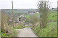
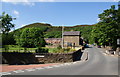
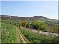
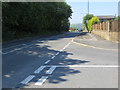
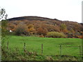
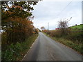
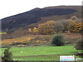
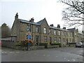
Photos of OL5 9LE


Area Information
OL5 9LE occupies a small, defined residential cluster measuring just 1.3 hectares. This compact footprint houses 1,529 people, creating one of the most densely populated residential pockets in the country with a density of 118,810 people per square kilometre. Living in this postcode means residing in a tightly knit environment where proximity is unavoidable and daily interactions are frequent. The area functions as a distinct micro-community rather than a sprawling neighbourhood typical of larger urban zones. Its primary character is defined by a high concentration of residents within a limited geographical boundary. This density influences the pace of life, offering immediate access to local services while imposing constraints on open space and quiet retreats. The sheer number of inhabitants relative to the land area suggests a neighbourhood where communal living is the norm. Prospective buyers must appreciate that this is a specific slice of urban life with significant population pressure. The physical scale of OL5 9LE does not expand to offer suburban sprawl; it remains a concentrated residential node. Understanding this density is essential for anyone considering homes in this specific location. The area represents a focused living experience where public and private spheres overlap significantly due to the tight spatial layout.
- Area Type
- Postcode
- Area Size
- 1.3 hectares
- Population
- 1529
- Population Density
- 4329 people/km²
Homes in OL5 9LE exist within a property market heavily skewed towards ownership rather than private renting. With 81 per cent of the population classified as homeowners, the area functions primarily as an established owner-occupied market. The predominant accommodation type is houses, reflecting this ownership culture and the preferences of the local demographic. This structure suggests a stable housing stock where properties are likely passed down through generations or purchased for long-term family use. For buyers, this indicates a market where competition comes from exchanging one home for another locally rather than investing in a rental asset for yield. The concentration of house ownership supports local service models that cater to homeowners, such as general repair services rather than short-term lettings agencies. The limited area size of 1.3 hectares constrains new development potential, meaning the character of the housing is fixed and unlikely to change rapidly. Those looking at OL5 9LE should expect to find traditional residential settings defined by the existing stock of houses. The market here is not driven by speculative house flipping but by settled residents buying into a known community. This dynamic creates a predictable environment for property transactions without the volatility common in high-density rental hotspots.
House Prices in OL5 9LE
Showing 8 properties
| Address | Type | Beds | Baths | Last Sale Price | Last Sale Date | |
|---|---|---|---|---|---|---|
| 8 Richmond Close, Mossley, OL5 9LE | Bungalow | 2 | 1 | £240,000 | May 2024 | |
| 1 Richmond Close, Mossley, OL5 9LE | Semi-detached | 3 | - | £160,000 | Mar 2019 | |
| 3 Richmond Close, Mossley, OL5 9LE | Bungalow | 2 | 1 | £112,000 | Aug 2017 | |
| 5 Richmond Close, Mossley, OL5 9LE | Bungalow | 3 | 1 | £118,000 | Aug 2011 | |
| 6 Richmond Close, Mossley, OL5 9LE | Bungalow | 2 | 1 | - | - | |
| 4 Richmond Close, Mossley, OL5 9LE | house | - | - | - | - | |
| 2 Richmond Close, Mossley, OL5 9LE | Semi-detached | - | - | - | - | |
| 7 Richmond Close, Mossley, OL5 9LE | Semi-detached | - | - | - | - |
Energy Efficiency in OL5 9LE
Residents of OL5 9LE have practical access to a range of amenities, though these facilities are located just outside the immediate 1.3-hectare boundary. Within reasonable travel distance lie five rail stations, including Mossley Railway Station, Greenfield Railway Station, and Stalybridge Railway Station. This network provides regular rail connections for commuting further afield. For daily shopping needs, five retail options are nearby, such as Spar, Co-op Mossley, and Spar Huddersfield. These venues offer essential grocery supplies and general goods without requiring a long journey. Transport links are further supported by five Metro bus stops, featuring services to Oldham Mumps, Ashton West, and Oldham Central. These bus routes connect the area to wider transport hubs and local districts. Living in this postcode means accepting that significant amenities are a short trip away rather than being immediately on your doorstep. The reliance on Mossley, Greenfield, and Stalybridge for rail travel defines the commuter pattern. While the immediate cluster is self-contained for housing, the lifestyle depends on these external nodes. You will find convenience stores and public transport hubs a few minutes away, sustaining the daily routine effectively.
Amenities
Schools
Families in OL5 9LE have direct access to All Saints CofE Infant School, which serves as the primary educational institution listed for the area. This school offers early years education to local children within the specific community context. The presence of a Church of England Infant School indicates a specific religious educational foundation available near the postcode. While no secondary schools are listed in the immediate vicinity, the proximity to primary education ensures that young children have a school close to the 1.3 hectare residential cluster. The school type and designation are key facts for parents evaluating education options for infants. Living in OL5 9LE provides convenient access to this specific named educational facility. The limited school data suggests that residents may need to travel further for secondary or high year primary education options outside the immediate cluster. Nevertheless, the availability of All Saints CofE Infant School places a reputable educational service within practical reach of households. This single resource highlights the focus on early childhood education for the area. Parents should verify catchment areas for specific years, as the data only confirms the presence of the infant school.
| Rank | School | Type | Entry gender | Ages |
|---|
Explore more schools in this area
Go to Schools tabDemographics
The community in OL5 9LE presents a mature demographic profile centred on adults aged between 30 and 64 years. The median age for residents is 47, indicating a neighbourhood dominated by established households rather than young families or empty nesters. This age distribution shapes the local demand for stability and long-term tenancy agreements. Within this population, 81 per cent of residents own their homes outright or with a mortgage. This high rate of home ownership creates a stable, settled population with a strong commitment to the locality. The prevailing accommodation type consists of houses, which aligns with the ownership figures and the maturity of the resident base. White residents form the predominant ethnic group within the area. These demographic facts define the social fabric of OL5 9LE. The lack of a significant rental sector and the prevalence of house ownership suggest a quiet, owner-occupied street life. The age profile means that services tailored to younger adults or very young children may be less relevant to the core daily needs of the majority. Instead, the community reflects the needs of working-age professionals and those approaching or in retirement. Living here involves joining a demographic group that values security and established local presence.
Household Size
Accommodation Type
Tenure
Ethnic Group
Religion
Household Composition
Age
Household Deprivation
NS-SEC
Explore more demographic insights in this area
Go to Demographics tabPlanning
Planning Constraints
- Flood RiskPremium
- Ramsar Wetland SitesPremium
- Area of Outstanding Natural BeautyPremium
- Protected Nature ReservePremium
- Protected WoodlandPremium