Area Overview for OL5 9HY
Photos of OL5 9HY
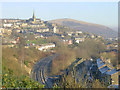
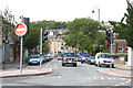
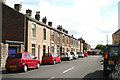
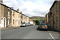
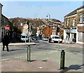
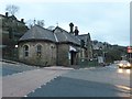
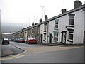
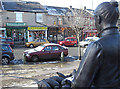
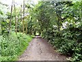
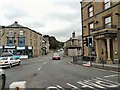
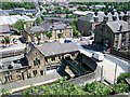
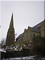
100 photos from this area
Area Information
Key information about the OL5 9HY including its size, population, and administrative classification.
- Area Type
- Postcode
- Area Size
- 7195 m²
- Population
- 1447
- Population Density
- 1651 people/km²
House Prices in OL5 9HY
22
Properties
£92,407
Average Sold Price
£38,800
Lowest Price
£245,000
Highest Price
Showing 22 properties
| Address | Type | Beds | Baths | Last Sale Price | Last Sale Date | |
|---|---|---|---|---|---|---|
| 18 Church Lane, Mossley, OL5 9HY | Terraced | 2 | 1 | £111,000 | Jan 2019 | |
| 24 Church Lane, Mossley, OL5 9HY | Terraced | 3 | 1 | £134,000 | Sep 2017 | |
| 12 Church Lane, Mossley, OL5 9HY | Terraced | 2 | - | £104,000 | Jan 2017 | |
| The Old Vicarage, Church Lane, Mossley, OL5 9HY | Detached | 4 | - | £245,000 | Nov 2015 | |
| 10 Church Lane, Mossley, OL5 9HY | Terraced | 2 | 1 | £80,000 | Jun 2015 | |
| 4 Church Lane, Mossley, OL5 9HY | Terraced | - | - | £94,000 | Jan 2009 | |
| 14 Church Lane, Mossley, OL5 9HY | Terraced | 3 | 1 | £86,000 | Jul 2008 | |
| 34 Church Lane, Mossley, OL5 9HY | house | - | - | £85,000 | Aug 2005 | |
| 30 Church Lane, Mossley, OL5 9HY | Terraced | 2 | 1 | £92,000 | Nov 2004 | |
| 26 Church Lane, Mossley, OL5 9HY | Terraced | - | - | £41,000 | Feb 2002 |
Page 1 of 3
Energy Efficiency in OL5 9HY
Amenities
Schools
| Rank | School | Type | Entry gender | Ages |
|---|
Explore more schools in this area
Go to Schools tabDemographics
Household Size
Two person
most common
Accommodation Type
Houses
most common
Tenure
77
majority
Ethnic Group
White
most common
Religion
N/A
most common
Household Composition
N/A
most common
Age
47
median
Adults (30-64 years)
most common
Household Deprivation
N/A
with no deprivation
NS-SEC
34
in Lower managerial occupations
Explore more demographic insights in this area
Go to Demographics tabPlanning
Planning Constraints
- Flood RiskPremium
- Ramsar Wetland SitesPremium
- Area of Outstanding Natural BeautyPremium
- Protected Nature ReservePremium
- Protected WoodlandPremium