Area Overview for OL5 0AQ
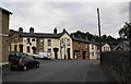
Photos of OL5 0AQ
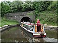
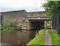
![Bottoms Bridge [no. 91] in OL5 0AQ](https://images.propbar.co.uk/images/geograph/18/80/1880195_120.jpg)

87 photos from this area
Area Information
Key information about the OL5 0AQ including its size, population, and administrative classification.
- Area Type
- Postcode
- Area Size
- 4384 m²
- Population
- 2078
- Population Density
- 3957 people/km²
House Prices in OL5 0AQ
12
Properties
£105,048
Average Sold Price
£3,000
Lowest Price
£370,000
Highest Price
Showing 12 properties
| Address | Type | Beds | Baths | Last Sale Price | Last Sale Date | |
|---|---|---|---|---|---|---|
| 3 Sandy Acre, Mossley, OL5 0AQ | Semi-detached | 4 | 3 | £370,000 | Jan 2025 | |
| 1 Sandy Acre, Mossley, OL5 0AQ | Semi-detached | - | - | £3,000 | Feb 2021 | |
| 4 Sandy Acre, Mossley, OL5 0AQ | Bungalow | - | - | £169,000 | Aug 2019 | |
| 19 Sandy Acre, Mossley, OL5 0AQ | Detached | 4 | - | £3,525 | Sep 2016 | |
| 2 Sandy Acre, Mossley, OL5 0AQ | house | - | - | £187,950 | Dec 2003 | |
| 9 Sandy Acre, Mossley, OL5 0AQ | Semi-detached | 3 | 1 | £35,000 | Mar 2000 | |
| 6 Sandy Acre, Mossley, OL5 0AQ | Semi-detached | - | - | £65,000 | Mar 2000 | |
| 15 Sandy Acre, Mossley, OL5 0AQ | Semi-detached | - | - | £69,500 | Mar 2000 | |
| 7 Sandy Acre, Mossley, OL5 0AQ | Semi-detached | - | - | £69,500 | Sep 1999 | |
| 5 Sandy Acre, Mossley, OL5 0AQ | Semi-detached | - | - | £78,000 | Sep 1999 |
Page 1 of 2
Energy Efficiency in OL5 0AQ
Amenities
Schools
| Rank | School | Type | Entry gender | Ages |
|---|
Explore more schools in this area
Go to Schools tabDemographics
Household Size
One person
most common
Accommodation Type
Houses
most common
Tenure
56
majority
Ethnic Group
White
most common
Religion
N/A
most common
Household Composition
N/A
most common
Age
47
median
Adults (30-64 years)
most common
Household Deprivation
N/A
with no deprivation
NS-SEC
35
in Lower managerial occupations
Explore more demographic insights in this area
Go to Demographics tabPlanning
Planning Constraints
- Flood RiskPremium
- Ramsar Wetland SitesPremium
- Area of Outstanding Natural BeautyPremium
- Protected Nature ReservePremium
- Protected WoodlandPremium