Area Overview for OL4 5HD
Photos of OL4 5HD


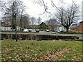

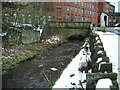
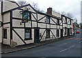
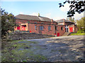

41 photos from this area
Area Information
Key information about the OL4 5HD including its size, population, and administrative classification.
- Area Type
- Postcode
- Area Size
- 2785 m²
- Population
- 1862
- Population Density
- 4239 people/km²
House Prices in OL4 5HD
28
Properties
£64,885
Average Sold Price
£700
Lowest Price
£125,000
Highest Price
Showing 28 properties
| Address | Type | Beds | Baths | Last Sale Price | Last Sale Date | |
|---|---|---|---|---|---|---|
| 66 Quail Street, Oldham, OL4 5HD | Terraced | 2 | 1 | £105,000 | Jul 2024 | |
| 40 Quail Street, Oldham, OL4 5HD | Terraced | 2 | 1 | £112,000 | Jun 2024 | |
| 54 Quail Street, Oldham, OL4 5HD | house | 2 | 1 | £75,000 | Mar 2023 | |
| 50 Quail Street, Oldham, OL4 5HD | house | - | - | £125,000 | Jan 2023 | |
| 62 Quail Street, Oldham, OL4 5HD | house | - | - | £84,000 | Mar 2022 | |
| 38 Quail Street, Oldham, OL4 5HD | house | - | - | £82,000 | Jan 2022 | |
| 44 Quail Street, Oldham, OL4 5HD | house | - | - | £700 | Aug 2021 | |
| 36 Quail Street, Oldham, OL4 5HD | Terraced | 2 | - | £65,000 | Nov 2019 | |
| 56 Quail Street, Oldham, OL4 5HD | Terraced | 2 | 1 | £64,000 | Jan 2019 | |
| 48 Quail Street, Oldham, OL4 5HD | Terraced | 2 | - | £69,950 | Oct 2018 |
Page 1 of 3
Energy Efficiency in OL4 5HD
Amenities
Schools
| Rank | School | Type | Entry gender | Ages |
|---|
Explore more schools in this area
Go to Schools tabDemographics
Household Size
Family (3-5 people)
most common
Accommodation Type
Houses
most common
Tenure
62
majority
Ethnic Group
White
most common
Religion
N/A
most common
Household Composition
N/A
most common
Age
47
median
Adults (30-64 years)
most common
Household Deprivation
N/A
with no deprivation
NS-SEC
19
in Lower managerial occupations
Explore more demographic insights in this area
Go to Demographics tabPlanning
Planning Constraints
- Flood RiskPremium
- Ramsar Wetland SitesPremium
- Area of Outstanding Natural BeautyPremium
- Protected Nature ReservePremium
- Protected WoodlandPremium