Area Overview for OL4 4HS
Photos of OL4 4HS
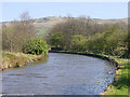
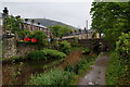
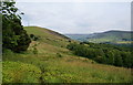
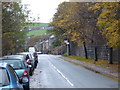
62 photos from this area
Area Information
Key information about the OL4 4HS including its size, population, and administrative classification.
- Area Type
- Postcode
- Area Size
- 8224 m²
- Population
- 1719
- Population Density
- 530 people/km²
House Prices in OL4 4HS
16
Properties
£241,114
Average Sold Price
£64,000
Lowest Price
£335,000
Highest Price
Showing 16 properties
| Address | Type | Beds | Baths | Last Sale Price | Last Sale Date | |
|---|---|---|---|---|---|---|
| 25 Highbank Crescent, Grasscroft, OL4 4HS | house | - | - | £322,250 | Apr 2023 | |
| 5 Highbank Crescent, Grasscroft, OL4 4HS | Semi-detached | 3 | - | £335,000 | Nov 2022 | |
| 23 Highbank Crescent, Grasscroft, OL4 4HS | Semi-detached | 3 | 1 | £283,000 | Jun 2022 | |
| 1 Highbank Crescent, Grasscroft, OL4 4HS | Semi-detached | 3 | 1 | £280,000 | Jan 2021 | |
| 11 Highbank Crescent, Grasscroft, OL4 4HS | house | - | - | £240,000 | Apr 2019 | |
| 8 Highbank Crescent, Grasscroft, OL4 4HS | Semi-detached | 2 | 2 | £271,000 | Mar 2019 | |
| 6 Highbank Crescent, Grasscroft, OL4 4HS | Semi-detached | 3 | - | £263,000 | Oct 2018 | |
| 4 Highbank Crescent, Grasscroft, OL4 4HS | house | - | - | £240,000 | Dec 2013 | |
| 19 Highbank Crescent, Grasscroft, OL4 4HS | house | - | - | £175,000 | Nov 2007 | |
| 21 Highbank Crescent, Grasscroft, OL4 4HS | Semi-detached | - | - | £179,000 | Dec 2006 |
Page 1 of 2
Energy Efficiency in OL4 4HS
Amenities
Schools
| Rank | School | Type | Entry gender | Ages |
|---|
Explore more schools in this area
Go to Schools tabDemographics
Household Size
Two person
most common
Accommodation Type
Houses
most common
Tenure
86
majority
Ethnic Group
White
most common
Religion
N/A
most common
Household Composition
N/A
most common
Age
47
median
Adults (30-64 years)
most common
Household Deprivation
N/A
with no deprivation
NS-SEC
52
in Lower managerial occupations
Explore more demographic insights in this area
Go to Demographics tabPlanning
Planning Constraints
- Flood RiskPremium
- Ramsar Wetland SitesPremium
- Area of Outstanding Natural BeautyPremium
- Protected Nature ReservePremium
- Protected WoodlandPremium