Area Overview for OL4 4EU
Photos of OL4 4EU
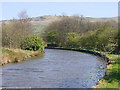
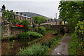
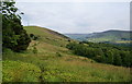
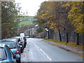
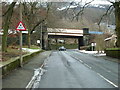
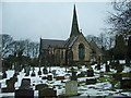
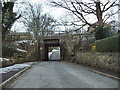
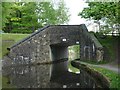
62 photos from this area
Area Information
Key information about the OL4 4EU including its size, population, and administrative classification.
- Area Type
- Postcode
- Area Size
- 1.0 hectares
- Population
- 1407
- Population Density
- 951 people/km²
House Prices in OL4 4EU
15
Properties
£326,200
Average Sold Price
£67,000
Lowest Price
£740,000
Highest Price
Showing 15 properties
| Address | Type | Beds | Baths | Last Sale Price | Last Sale Date | |
|---|---|---|---|---|---|---|
| 3 Brookway, Grasscroft, OL4 4EU | Detached | 4 | 3 | £740,000 | Apr 2024 | |
| 2 Brookway, Grasscroft, OL4 4EU | Semi-detached | 5 | 3 | £620,000 | Jul 2023 | |
| 9 Brookway, Grasscroft, OL4 4EU | house | - | - | £455,000 | Mar 2021 | |
| 20 Brookway, Grasscroft, OL4 4EU | house | - | - | £392,000 | Dec 2020 | |
| 16 Brookway, Grasscroft, OL4 4EU | house | - | - | £225,000 | Jun 2016 | |
| 18 Brookway, Grasscroft, OL4 4EU | house | 3 | - | £222,000 | Jul 2014 | |
| 11 Brookway, Grasscroft, OL4 4EU | Bungalow | - | - | £320,000 | Jan 2012 | |
| 12 Brookway, Grasscroft, OL4 4EU | Semi-detached | - | - | £67,000 | Nov 1998 | |
| 1 Brookway, Grasscroft, OL4 4EU | Detached | - | - | £110,000 | Aug 1997 | |
| 7 Brookway, Grasscroft, OL4 4EU | Semi-detached | - | - | £111,000 | Apr 1997 |
Page 1 of 2
Energy Efficiency in OL4 4EU
Amenities
Schools
| Rank | School | Type | Entry gender | Ages |
|---|
Explore more schools in this area
Go to Schools tabDemographics
Household Size
Two person
most common
Accommodation Type
Houses
most common
Tenure
89
majority
Ethnic Group
White
most common
Religion
N/A
most common
Household Composition
N/A
most common
Age
47
median
Adults (30-64 years)
most common
Household Deprivation
N/A
with no deprivation
NS-SEC
48
in Lower managerial occupations
Explore more demographic insights in this area
Go to Demographics tabPlanning
Planning Constraints
- Flood RiskPremium
- Ramsar Wetland SitesPremium
- Area of Outstanding Natural BeautyPremium
- Protected Nature ReservePremium
- Protected WoodlandPremium