Area Overview for OL4 2NU
Photos of OL4 2NU


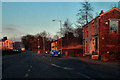
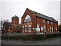
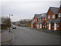
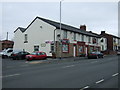
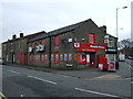
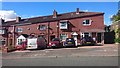
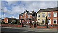
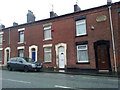
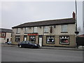
20 photos from this area
Area Information
Key information about the OL4 2NU including its size, population, and administrative classification.
- Area Type
- Postcode
- Area Size
- 3454 m²
- Population
- 1464
- Population Density
- 8873 people/km²
House Prices in OL4 2NU
23
Properties
£71,239
Average Sold Price
£34,950
Lowest Price
£150,000
Highest Price
Showing 23 properties
| Address | Type | Beds | Baths | Last Sale Price | Last Sale Date | |
|---|---|---|---|---|---|---|
| 346 Ripponden Road, Oldham, OL4 2NU | Terraced | 3 | 1 | £150,000 | Sep 2023 | |
| 358 Ripponden Road, Oldham, OL4 2NU | Terraced | 2 | 1 | £105,000 | Jul 2023 | |
| 376 Ripponden Road, Oldham, OL4 2NU | house | 2 | 1 | £90,000 | Sep 2021 | |
| 384 Ripponden Road, Oldham, OL4 2NU | Terraced | 3 | 1 | £85,000 | Jul 2019 | |
| 364 Ripponden Road, Oldham, OL4 2NU | Terraced | 2 | 1 | £85,000 | Feb 2018 | |
| 378 Ripponden Road, Oldham, OL4 2NU | house | - | - | £66,500 | Nov 2016 | |
| 362 Ripponden Road, Oldham, OL4 2NU | Terraced | 3 | 1 | £79,000 | Dec 2015 | |
| 356 Ripponden Road, Oldham, OL4 2NU | house | 2 | - | £62,000 | Mar 2014 | |
| 350 Ripponden Road, Oldham, OL4 2NU | Terraced | - | - | £60,000 | Oct 2009 | |
| 360 Ripponden Road, Oldham, OL4 2NU | house | 3 | - | £45,000 | Jun 2005 |
Page 1 of 3
Energy Efficiency in OL4 2NU
Amenities
Schools
| Rank | School | Type | Entry gender | Ages |
|---|
Explore more schools in this area
Go to Schools tabDemographics
Household Size
Family (3-5 people)
most common
Accommodation Type
Houses
most common
Tenure
80
majority
Ethnic Group
White
most common
Religion
N/A
most common
Household Composition
N/A
most common
Age
47
median
Adults (30-64 years)
most common
Household Deprivation
N/A
with no deprivation
NS-SEC
30
in Lower managerial occupations
Explore more demographic insights in this area
Go to Demographics tabPlanning
Planning Constraints
- Flood RiskPremium
- Ramsar Wetland SitesPremium
- Area of Outstanding Natural BeautyPremium
- Protected Nature ReservePremium
- Protected WoodlandPremium