Area Overview for OL4 1LF
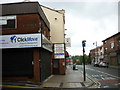
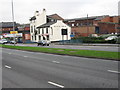
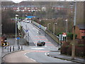
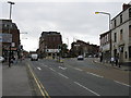
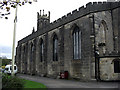
Photos of OL4 1LF


Area Information
Living in OL4 1LF means residing within a specific postcode area covering a small residential cluster in England. This neighbourhood forms part of the broader Oldham landscape, yet it maintains a defined character with a population of 1,827 residents. The postcode serves as a focal point for local life, offering a contained community feel that contrasts with the wider urban sprawl. Residents here experience a distinct daily rhythm, shaped by the proximity of local amenities and the specific housing stock available. The area functions as a practical base for commuting, with rail connections to Mills Hill, Mossley, and Moston Railway Station all within practical reach. Shops like Tesco Oldham and Sainsburys Oldham are nearby, ensuring essential goods are accessible without long travel times. For those considering homes in OL4 1LF, the location offers a blend of independence and community access. You are situated close to metro hubs at Oldham Mumps, Derker, and Oldham Central, providing flexibility for travel across Greater Manchester. The digital infrastructure supports modern living needs, with fixed broadband quality reaching an excellent standard suitable for working from home. Safety assessments indicate low risks regarding flooding and environmental planning constraints, providing peace of mind for current and future occupants. The area is defined by its residential nature and the necessity to navigate local transport links effectively. This postcode represents a specific choice for individuals seeking a home in a defined part of Oldham with access to key services.
- Area Type
- Postcode
- Area Size
- Not available
- Population
- 1827
- Population Density
- 3585 people/km²
The property market in OL4 1LF is characterised by a specific balance of ownership and rental tenure. With home ownership recorded at 23%, this small residential area functions largely as a rental market. Most people renting homes in OL4 1LF do not own their properties outright, which influences pricing pressures and the availability of purchase listings. The predominant accommodation type is houses, meaning single-family homes offer the primary option for buyers in this postcode. This contrasts with urban centres where flats might be the norm for such a population size. For those looking to buy, you will encounter fewer immediate purchase options compared to owner-occupied districts. The low ownership rate suggests that many of the available houses are part of a long-term rental pipeline. However, this does not diminish the value of the housing stock itself. The presence of houses implies a certain level of space and garden access that is highly sought after. If you are entering the property market here, competition will focus on these specific house types rather than multi-story apartments. The market dynamics reflect a community where lettings play a larger role than sales. This structure provides stability for tenants but requires diligent searching for those wishing to purchase a home in a area with limited owner-occupier turnover.
House Prices in OL4 1LF
No properties found in this postcode.
Energy Efficiency in OL4 1LF
Daily life for residents of OL4 1LF is supported by a cluster of amenities within practical reach. Five notable retail locations are available to meet daily shopping needs. You can find Tesco Oldham and Sainsburys Oldham nearby, providing access to major supermarkets for groceries and household essentials. Heron Werneth is another key retail destination in this category. For trips beyond local shopping, five metro stations offer connections to Oldham Mumps, Derker, and Oldham Central. These locations facilitate travel to wider commercial sectors without requiring personal vehicle travel. This concentration of services creates a convenient lifestyle without the need to travel far. If you spend your evening at one of these retail spots or use the metro to reach work or leisure activities, your radius of travel remains manageable. The area balances residential quiet with the accessibility of major chains and transport hubs. You do not need to venture deep into the city centre for basic provisions. The presence of these five retail and five metro options ensures that your weekly routine can be satisfied efficiently. Lifestyle choices here are defined by this efficient access to goods and transport, allowing you to maintain a manageable balance between home and the wider region.
Amenities
Schools
Families living near OL4 1LF benefit from access to specific educational institutions with verified ratings. Beever Primary School stands as the main nearby educational facility for younger children. Located in close proximity, it serves students within the local catchment area and holds a good Ofsted rating. This rating confirms that the school meets high standards for education, safety, and student outcomes. For parents, this is a key consideration when evaluating homes in OL4 1LF. The designation as a primary school means it caters to children from early years through to Key Stage 2. The mix of schools near OL4 1LF is concise, centreing on this single primary establishment in the immediate vicinity. While secondary education options are not listed for this specific postcode data, the rating of Beever Primary provides a solid foundation for families with young children. A good Ofsted rating reduces anxiety regarding the quality of early education your children will receive. This specific school location is a fixed feature of the area, offering certainty to homebuyers. When comparing properties, proximity to Beever Primary becomes a significant factor in decision-making. The reliable performance of the school adds tangible value to homes in this neighbourhood for school-age families.
| Rank | School | Type | Entry gender | Ages |
|---|
Explore more schools in this area
Go to Schools tabDemographics
The community in OL4 1LF is defined by a mature population profile. The median age for residents is 47 years, reflecting a demographic where Adults aged between 30 and 64 years represent the most common age range. This age structure suggests a neighbourhood dominated by established families and long-term residents rather than young professionals or retirees. Consequently, the social environment tends to be stable, with community dynamics revolving around mid-life stages and established household routines. Home ownership stands at 23%, indicating that a significant majority of residents rent their accommodation. This high rental proportion shapes the local culture and interaction patterns among households. Ethnically, White residents form the predominant group within this specific postcode area. The housing stock consists primarily of houses, distinguishing it from suburban areas where flats or terraced terrain might dominate. The combination of older age demographics with a rental-heavy market creates a unique residential texture. You might find neighbours who have lived in their houses for decades, while investment landlords manage properties for tenants seeking stability. The area does not show signs of extreme youth influx or rapid demographic shifts; instead, it maintains a consistent character. Understanding these figures helps potential buyers anticipate the daily social fabric, from local school interactions to community events hosted by the resident population.
Household Size
Accommodation Type
Tenure
Ethnic Group
Religion
Household Composition
Age
Household Deprivation
NS-SEC
Explore more demographic insights in this area
Go to Demographics tabPlanning
Planning Constraints
- Flood RiskPremium
- Ramsar Wetland SitesPremium
- Area of Outstanding Natural BeautyPremium
- Protected Nature ReservePremium
- Protected WoodlandPremium