Area Overview for OL4 1HN
Photos of OL4 1HN


Area Information
OL4 1HN is a specific postcode area located in Oldham, covering a small residential cluster within Greater Manchester. The housing stock here caters to a population of 2365 residents who navigate their daily lives from this established neighbourhood. You can expect a compact community where homes are situated within close proximity to each other. This postcode serves as a gateway for many who work in the wider West Yorkshire and North West regions. The area offers a straightforward layout for those seeking practical living without the sprawl of larger towns. You will find that the immediate surroundings are designed for pedestrians and local access rather than expansive green spaces. The residential nature of OL4 1HN means that noise levels are generally manageable, largely due to the focus on housing units rather than light industrial use. Daily life revolves around a core of households that balance work and home. The specific boundaries of this postcode allow for a tight-knit environment where neighbours often know one another through shared amenities. You should consider this location if you prioritise manageable commute times and a defined residential footprint. The area represents a standard example of suburban living in the Oldham district.
- Area Type
- Postcode
- Area Size
- Not available
- Population
- 2365
- Population Density
- 8510 people/km²
The property market in OL4 1HN is characterised by a diverse mix of ownership, with homeowners and tenants representing equal shares of the population. The figure stands at exactly 50% home ownership, creating a dynamic environment where fixed-term investments meet long-term residence. This balance suggests that the area attracts various buyers rather than being dominated by a single investor group. All accommodation within this postcode consists of houses, offering a uniform backdrop of detached or semi-detached structures. You will not encounter converted flats or purpose-built apartment blocks here. This consistent housing type implies that maintenance responsibilities and council tax bands generally follow traditional house categories. For those seeking rental properties in OL4 1HN, the 50% tenant rate indicates a steady demand for private rentals alongside social housing. The scarcity of shared ownership or new-build listings is not explicit in the current data, so you should assume a mature stock of existing properties. Buyers looking for a family home will find that the majority of houses are available in this category. The market does not rely on luxury developments or eye-catching contemporary architecture but rather on proven residential stock. This makes OL4 1HN a practical choice for anyone needing a standard family layout without the premium of a new development.
House Prices in OL4 1HN
No properties found in this postcode.
Energy Efficiency in OL4 1HN
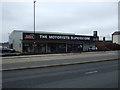
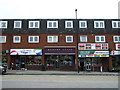
Your daily life in OL4 1HN benefits from immediate access to a varied range of retail and transport hubs. Within practical reach, you will find five major retail locations that serve the local community. Notable supermarkets including Tesco Oldham, Asda Oldham, and Aldi Athens Way provide daily essentials and shopping opportunities without needing to travel far. Beyond food outlets, the area is well-connected by rail, giving you access to five key railway stations nearby. Station hubs such as Mossley Railway Station, Greenfield Railway Station, and Mills Hill Railway Station offer reliable links to Oldham and Manchester. For those driving, five metro stop locations are available, with services departing from Oldham Mumps, Derker, and Oldham Central. These transport nodes reduce the time spent commuting and expand your access to jobs and leisure activities. The presence of multiple retail chains and rail stations means you can fulfil household needs efficiently. You will appreciate the convenience of having Asda and Aldi within easy reach for weekly groceries. The rail network specifically connects you to broader destinations quickly. This blend of shopping destinations and transport links defines the lifestyle here as functional and accessible.
Amenities
Schools
| Rank | School | Type | Entry gender | Ages |
|---|
Explore more schools in this area
Go to Schools tabDemographics
The community within OL4 1HN is defined by a distinct age profile and household composition. The median age for residents sits at 22 years, which is remarkably young compared to the national average and suggests a youthful demographic. Despite this low median figure, the most common age range comprises adults between 30 and 64 years. You may find homes in OL4 1HN occupied by families in their prime earning years alongside younger couples or single professionals. Diversity plays a significant role in the character of this neighbourhood, as Asian residents form the predominant ethnic group in this postcode. This cultural presence shapes the local identity without overshadowing the British heritage found throughout the wider region. Regarding housing stability, exactly 50% of households own their homes. This split indicates a balanced market where investment buyers and first-time purchasers operate in tandem with local owners. The accommodation type is exclusively houses, meaning you will not find flats or high-rise apartments within this specific boundary. You should note that this uniformity in housing style creates a consistent streetscape across the entire cluster. The demographic data points to a community that is stable yet evolving, with a strong base of working-age adults managing family responsibilities in a traditional suburban setting.
Household Size
Accommodation Type
Tenure
Ethnic Group
Religion
Household Composition
Age
Household Deprivation
NS-SEC
Explore more demographic insights in this area
Go to Demographics tabPlanning
Planning Constraints
- Flood RiskPremium
- Ramsar Wetland SitesPremium
- Area of Outstanding Natural BeautyPremium
- Protected Nature ReservePremium
- Protected WoodlandPremium