Area Overview for OL3 6BU
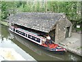
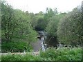
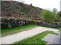
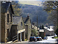
Photos of OL3 6BU


Area Information
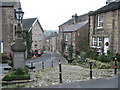
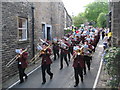
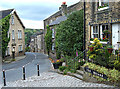
The postcode sector OL3 6BU contains a small residential cluster occupying just 1.4 hectares with a population of 1563. The area is defined by a low population density of 894 people per square kilometre, which suggests a relatively spacious living environment compared to the larger cities nearby. Residents in this specific location benefit from a setting that prioritises quietude over the hustle of major urban centres. The neighbourhood focuses exclusively on residential needs, creating a distinct separation from the wider industrial or commercial zones that often surround such small postcodes in Greater Manchester. For anyone considering living in OL3 6BU, the primary draw is the manageable scale of the area, which fosters a sense of familiarity and community without the chaos of metropolitan sprawl. You can expect a peaceable environment where the immediate surroundings are tightly controlled and affluent in terms of density but generous in physical space. The area serves as a compact pocket of residential housing, offering a specific type of retreat for those seeking a home in the Saddleworth outskirts of Oldham.
- Area Type
- Postcode
- Area Size
- 1.4 hectares
- Population
- 1563
- Population Density
- 894 people/km²
Homes in OL3 6BU consist almost entirely of houses, reflecting the area's established character. With 73 per cent of residents owning their homes, the market is defined by owner-occupied dwellings rather than purpose-built rentals or new builds. This high level of home ownership indicates that the housing stock comprises older properties that previous generations purchased and lived in, rather than a modern estate of flats. Buyers looking at this specific postcode will find a environment where family homes are the norm. You are unlikely to encounter large blocks of flats or high-density apartments typical of newer urban developments in Greater Manchester. The fact that the majority of residents are owners suggests a consistent and predictable market where values have historically been supported by owner-occupiers. For those seeking a traditional family home in a non-corporate setting, this area offers a stock that matches those requirements precisely. The absence of rental density points to a stable community where residents plan to stay put.
House Prices in OL3 6BU
Showing 1 properties
| Address | Type | Beds | Baths | Last Sale Price | Last Sale Date | |
|---|---|---|---|---|---|---|
| Saddleworth Secondary School, Huddersfield Road, Diggle, OL3 6BU | commercial | - | - | - | - |
Energy Efficiency in OL3 6BU
Daily life in OL3 6BU is supported by a set of amenities within practical reach that cater to standard shopping and travel needs. For your weekly shopping, you can visit Co-op Uppermill or Tesco Saddleworth, with a Co-op Delph also noted nearby to serve different neighborhoods. Travel links are provided by several nearby train stations including Greenfield Railway Station, Mossley Railway Station, and Marsden Railway Station. Metro connections are available through Shaw and Crompton, Derker, and Oldham Mumps, offering flexibility for those who need regular commute options. While the immediate area is residential, the proximity to these specific retail chains and transport hubs ensures you do not need to venture far for essentials. The locations of these stations provide easy access to the wider network for those who wish to travel beyond the local cluster. You have clear options for both food and transport, though the immediate area remains focused on residential quality over entertainment districts.
Amenities
Schools
Families considering living in OL3 6BU have access to a specific set of educational options nearby. The area is served by St Chad's CofE Primary School, which holds a good Ofsted rating, alongside Saddleworth School, which carries a satisfactory Ofsted rating. There is also St Chad's Church of England Primary School listed among the nearest institutions, providing another primary education option for local children. The mix of schools includes both academies and community comprehensive structures, offering variations in educational philosophy within a short distance. Parents should note that not all nearby institutions have a good rating, so research into specific schools is advised before moving. These named entities represent the core educational infrastructure for the postcode. The availability of primary schools is a clear advantage, while secondary education options are not explicitly detailed in the immediate vicinity of this specific cluster. The presence of multiple primary options gives local families some choice without needing to commute long distances for the earliest years of schooling.
| Rank | School | Type | Entry gender | Ages |
|---|
Explore more schools in this area
Go to Schools tabDemographics
The community in OL3 6BU is dominated by adults, with the most common age range falling between 30 and 64 years old. The median age for residents is 47, indicating an area settled by middle-aged families rather than young professionals or the elderly. A significant 73 per cent of households own their property, suggesting a stable, long-term residency pattern rather than a transient rental market. The accommodation type is exclusively houses, which aligns with a population that has typically moved up the property ladder over time. White people form the predominant ethnic group within this demographic profile. These figures describe a neighbourhood where household heads are likely established in their careers and have the financial means to own homes. The high ownership rate means buyers look for established neighbourhoods rather than speculative developments. This demographic data paints a picture of a mature suburb where families have put down roots for the long haul.
Household Size
Accommodation Type
Tenure
Ethnic Group
Religion
Household Composition
Age
Household Deprivation
NS-SEC
Explore more demographic insights in this area
Go to Demographics tabPlanning
Planning Constraints
- Flood RiskPremium
- Ramsar Wetland SitesPremium
- Area of Outstanding Natural BeautyPremium
- Protected Nature ReservePremium
- Protected WoodlandPremium