Area Overview for OL3 5AF
Photos of OL3 5AF


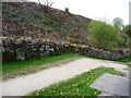

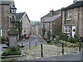


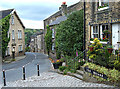


100 photos from this area
Area Information
Key information about the OL3 5AF including its size, population, and administrative classification.
- Area Type
- Postcode
- Area Size
- 6.0 hectares
- Population
- 1684
- Population Density
- 1080 people/km²
House Prices in OL3 5AF
11
Properties
£447,187
Average Sold Price
£124,999
Lowest Price
£795,000
Highest Price
Showing 11 properties
| Address | Type | Beds | Baths | Last Sale Price | Last Sale Date | |
|---|---|---|---|---|---|---|
| 1 Crib Lane, Dobcross, OL3 5AF | Terraced | 2 | 1 | £220,000 | Jan 2025 | |
| 6 Crib Lane, Dobcross, OL3 5AF | Detached | 4 | 3 | £795,000 | Oct 2023 | |
| Marvon, Crib Lane, Dobcross, OL3 5AF | house | - | - | £525,000 | Nov 2020 | |
| 11 Crib Lane, Dobcross, OL3 5AF | Terraced | - | - | £425,000 | Oct 2017 | |
| 4 Crib Lane, Dobcross, OL3 5AF | house | - | - | £555,000 | Sep 2017 | |
| 9A Crib Lane, Dobcross, OL3 5AF | house | - | - | £124,999 | Sep 2015 | |
| The Stables, Crib Lane, Dobcross, OL3 5AF | house | - | - | £640,000 | Dec 2014 | |
| 3 Crib Lane, Dobcross, OL3 5AF | Unknown | - | - | £292,500 | Oct 2003 | |
| 3A Crib Lane, Dobcross, OL3 5AF | Retail | - | - | - | - | |
| 9 Crib Lane, Dobcross, OL3 5AF | Unknown | - | - | - | - |
Page 1 of 2
Energy Efficiency in OL3 5AF
Amenities
Schools
| Rank | School | Type | Entry gender | Ages |
|---|
Explore more schools in this area
Go to Schools tabDemographics
Household Size
Two person
most common
Accommodation Type
Houses
most common
Tenure
80
majority
Ethnic Group
White
most common
Religion
N/A
most common
Household Composition
N/A
most common
Age
47
median
Adults (30-64 years)
most common
Household Deprivation
N/A
with no deprivation
NS-SEC
50
in Lower managerial occupations
Explore more demographic insights in this area
Go to Demographics tabPlanning
Planning Constraints
- Flood RiskPremium
- Ramsar Wetland SitesPremium
- Area of Outstanding Natural BeautyPremium
- Protected Nature ReservePremium
- Protected WoodlandPremium