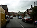
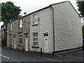
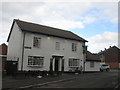
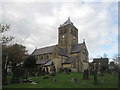
Area Overview for OL2 8SX
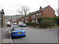
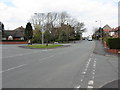
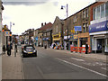
Photos of OL2 8SX


Area Information
OL2 8SX represents a very specific residential cluster within the Greater Manchester postcode district. You are looking at an area that covers just 3676 square metres, hosting a total population of 1647 people. This compact footprint creates a tight-knit environment where neighbours are likely to know one another by sight. The location is situated in Oldham, a town in north-west England, where daily life blends traditional local character with modern connectivity. You can expect a setting that prioritises residential use over commercial sprawl, given the small land area relative to the number of residents. Living in OL2 8SX means navigating a high-density environment despite the limited physical space, resulting in a community where every household occupies a significant portion of the local map. The area functions as a distinct neighbourhood unit rather than a sprawling district, offering a focused experience of town living. While the statistics show a high density of 448,078 people per square kilometre, this figure reflects the specific clustering of homes in this postcode sector. For prospective buyers, this translates to a sense of enclosure and proximity to amenities, but also a lack of open green space within the immediate boundary of the postcode itself.
- Area Type
- Postcode
- Area Size
- 3676 m²
- Population
- 1647
- Population Density
- 2269 people/km²
The property market in OL2 8SX is characterised by a housing stock composed almost entirely of houses. You are looking at an area where semi-detached, terraced, or detached homes form the backbone of the residential landscape, with no data suggesting a significant presence of flats or purpose-built apartment blocks. This composition dictates the type of properties available for purchase and the overall character of the streets. Home ownership stands at 43%, placing OL2 8SX slightly below the national average for owner-occupied housing. This figure indicates that while a substantial portion of residents buy their homes, rental activity remains a notable part of the local market. You might find a balance of long-term owner-occupiers alongside tenants seeking stability in this specific postcode. Because the area consists of a small residential cluster covering only 3676 square metres, the total number of properties available is limited. This scarcity can affect seller confidence and buyer competition. When viewing homes in OL2 8SX, expect standard family dwellings rather than luxury developments or student accommodations. The dominance of houses offers a traditional suburban feel, but the high population density for such a small land area suggests that land value is concentrated in this specific zone.
House Prices in OL2 8SX
Showing 8 properties
| Address | Type | Beds | Baths | Last Sale Price | Last Sale Date | |
|---|---|---|---|---|---|---|
| 6 Fenton Street, Shaw, OL2 8SX | Terraced | 3 | 1 | £130,000 | Mar 2024 | |
| 4 Fenton Street, Shaw, OL2 8SX | house | - | - | £125,000 | Sep 2021 | |
| 2 Fenton Street, Shaw, OL2 8SX | Terraced | 2 | 1 | £90,000 | May 2020 | |
| 8 Fenton Street, Shaw, OL2 8SX | house | - | - | £98,000 | Mar 2015 | |
| 7 Fenton Street, Shaw, OL2 8SX | house | 2 | - | £25,000 | Mar 1996 | |
| 3 Fenton Street, Shaw, OL2 8SX | Terraced | 2 | 1 | - | - | |
| 5 Fenton Street, Shaw, OL2 8SX | Terraced | - | - | - | - | |
| 1 Fenton Street, Shaw, OL2 8SX | house | - | - | - | - |
Energy Efficiency in OL2 8SX
Daily life in OL2 8SX is anchored by practical amenities located in Shaw and the surrounding villages within Oldham. Your shopping needs are met by several major retailers, including Co-op Shaw, Aldi Shaw, and Tesco Shaw. These supermarkets provide a one-stop solution for groceries and household essentials without the need for long drives. Retail options extend beyond these chains, with five other retail outlets accessible in close proximity. For commuting, public transport hubs such as Shaw and Crompton offer frequent metro and bus connections. Additional travel points include Derker railway station and Newhey railway station, expanding your mobility across the region. Rail connections via Mills Hill Railway Station also provide faster access to wider Manchester networks. While the data lists specific retail and transport venues, it does not detail leisure facilities such as theatres, cinemas, or parks within the immediate vicinity. However, the concentration of five metro stops and five railway stations suggests a well-connected neighbourhood where travel time is not a barrier to leisure activities elsewhere. Living in OL2 8SX means having your essential needs sorted through a cluster of reliable shops and efficient public transport routes.
Amenities
Schools
Families moving to OL2 8SX have access to specific educational options, though the immediate vicinity offers limited choice. The nearest school is Farrowdale House School, which operates as an independent institution. The Ofsted rating for this school is good, providing a verified standard of education for students in the local catchment or those seeking private education. You must note that this is the only school listed in the data for this area. The concentration of just one institution highlights a reliance on either this independent school or travel to other schools outside the immediate postcode boundary for comprehensive education. The presence of an independent school often indicates a demographic with the financial means to choose private education. There is no data provided regarding state primary or secondary schools in OL2 8SX, so you cannot make specific claims about local state provision. When planning for children, you will need to verify catchment areas for schools beyond Farrowdale House School, as the small geographical footprint means most educational journeys will involve significant travel. The mix is singular rather than diverse, lacking a range of school types within walking distance.
| Rank | School | Type | Entry gender | Ages |
|---|
Explore more schools in this area
Go to Schools tabDemographics
The community in OL2 8SX is defined by a mature demographic profile, with a median age of 47 years. You will find that the most common age range for residents falls between 30 and 64 years old, indicating a population made up largely of adults. This age structure suggests a community where stability is common, as many households are likely established rather than newly forming. Housing tenure reflects this mature profile, with home ownership standing at 43% of the total population. The remaining residents likely rent privately or through housing associations, a common mix in areas with this age skew. Accommodation in the zone consists primarily of houses, meaning you will not encounter flats as the dominant dwelling type. The area is predominantly white in terms of ethnic makeup, which aligns with the typical demographic composition of older Manchester suburbs. There is no data provided on deprivation levels, so you cannot make claims about income inequality or education outcomes based on official indices. However, the absence of younger families or elderly pensioners as a primary group suggests a working-age adult concentration. This demographic reality influences the types of businesses that thrive locally, favouring services that cater to established households rather than those targeting children or retirees.
Household Size
Accommodation Type
Tenure
Ethnic Group
Religion
Household Composition
Age
Household Deprivation
NS-SEC
Explore more demographic insights in this area
Go to Demographics tabPlanning
Planning Constraints
- Flood RiskPremium
- Ramsar Wetland SitesPremium
- Area of Outstanding Natural BeautyPremium
- Protected Nature ReservePremium
- Protected WoodlandPremium