Area Overview for OL2 8PJ
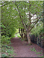
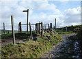
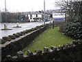
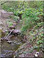
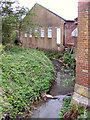
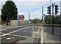
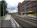
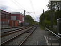
Photos of OL2 8PJ


Area Information
Buying a home in OL2 8PJ means securing a foothold in a compact residential cluster covering just four hectares. You will find yourself in a neighbourhood defined by high density, with a population of 1,647 people sharing a small footprint. This concentration of households creates a close-knit environment where daily interactions are more frequent than in sprawling suburbs. The area is situated in England, serving as a specific postcode zone within a larger local authority boundary. Living here offers proximity to key transport hubs without the isolation typical of remote rural pockets. The demographic profile suggests a community stabilised by long-term residents rather than transient occupants. You are looking at an area where house prices reflect its small size and the specific needs of families and professionals. While the physical space is limited, the concentration of services nearby compensates for the lack of green space within the cluster itself. Residents benefit from a structured community layout that prioritises easy access to essentials. The sheer volume of people per square millimetre means you can reach local amenities quickly. This specific cluster provides a manageable scale for those seeking a quiet yet accessible residence in Greater Manchester's urban fringe. Your day-to-day life centres on this dense residential core which connects directly to wider infrastructure networks.
- Area Type
- Postcode
- Area Size
- 4.0 hectares
- Population
- 1647
- Population Density
- 2269 people/km²
The property market in OL2 8PJ is characterised by a specific balance between owner occupancy and rental living. Only 43% of households are owner-occupied, which indicates a significant portion of residents rent their homes. This statistic shapes the market dynamics for prospective buyers who might find fewer owner-led communities compared to areas with higher ownership rates. Houses remain the predominant form of accommodation, though the relatively low ownership percentage suggests diverse tenancy arrangements. You are looking at a small area with limited inventory, making specific property listings competitive. The high population density of 41,604 people per square kilometre further constrains available land for new residential development. Existing homes frequently trade hands between tenants and landlords given the size of the residential cluster. Buyers should expect property values to be influenced by the immediate proximity to transport links and nearby schools. The composition of the housing stock means you may encounter a mix of tenure types rather than a monolithic private estate. Renting in OL2 8PJ offers immediate access to housing without the commitment of purchase, yet it contributes to lower overall home ownership figures. This market reality requires realistic expectations regarding investment returns and rental yields for landlords. The small four-hectare size means every property makes a noticeable impact on local housing supply. Your research into individual listings must therefore account for the limited land available for new builds or extensions.
House Prices in OL2 8PJ
Showing 2 properties
| Address | Type | Beds | Baths | Last Sale Price | Last Sale Date | |
|---|---|---|---|---|---|---|
| J D Williams And Co Limited, Lilac Mill, Beal Lane, Shaw, OL2 8PJ | storage_distribution | - | - | - | - | |
| Pump House, Lilac Mill, Beal Lane, Shaw, OL2 8PJ | Industrial | - | - | - | - |
Energy Efficiency in OL2 8PJ
Living in OL2 8PX offers immediate access to a curated array of retail and transport amenities. You can visit Shaw and Crompton, Derker, and Newhey for your metro and dining needs. Five key retail locations surround the area, including Asda Shaw, Aldi Shaw, and Iceland Shaw. These supermarkets ensure you can complete daily grocery shopping without travelling far. Five railway stations reinforce the convenience of public transport integration into your lifestyle. Frequent trains to Rochdale Railway Station, Mills Hill Railway Station, and Castleton Railway Station save you time. The concentration of convenience stores means you rarely lack basic necessities within walking or driving distance. Shopping trips remain quick and efficient due to the proximity of multiple national chains. The variety of metro options supports a balanced diet and healthy eating habits through easy food access. Your weekends can include visits to nearby villages without needing a long drive. The density of amenities compensates for the small physical size of the four-hectare residential zone. You do not need a car for routine errands given the density of shops. Dinner ideas come easily from the selection of eatables available at local merchants. The presence of three distinct railway hubs adds a layer of logistical ease to your daily routine. Residents enjoy a self-contained lifestyle where weekly tasks require minimal effort to complete.
Amenities
Schools
Families moving to OL2 8PJ have access to specific educational institutions within practical reach. Farrowdale House School stands as the primary independent option nearby. The school holds an Ofsted rating of good, providing a verified standard of education for children in the area. This single named institution suggests a reliance on independent provision or that state secondary options lie further afield. The presence of a good-rated independent school offers an alternative education path for families who choose that route. No state primary or secondary schools are listed in the immediate vicinity of the postcode. This situation requires parents to look beyond the immediate cluster for comprehensive schooling options. The availability of a good-rated independent school indicates a commitment to educational quality in the broader neighbourhood. Families must evaluate commute times from homes in OL2 8PJ to reach this independent institution safely. The school type influences community dynamics, as students and parents from different backgrounds often mix in this setting. When planning for children, you must factor in the transport requirements to reach Farrowdale House School. The lack of other listed schools highlights the specificity of this educational choice for the local population. Your decision to live here should align with your child's compatibility with independent schooling models.
| Rank | School | Type | Entry gender | Ages |
|---|
Explore more schools in this area
Go to Schools tabDemographics
The community in OL2 8PJ reflects a mature population profile with a median age of 47 years. Most residents fall into the thirty-to-sixty-four years category, indicating a neighbourhood favoured by established families and professionals near retirement. There is a moderate level of home ownership standing at 43%, meaning slightly fewer than half of the households own their properties outright. The majority of accommodation consists of houses, which contributes to the established character of the streets you will travel. Ethnically, the area is predominantly White, providing a clear sense of demographic composition. With a population density of 41,604 people per square kilometre, you are looking at a highly intensive living environment. This high density correlates with the small total area of four hectares. The age distribution suggests a stable community where children and elderly residents often live alongside working adults. The housing stock is designed to accommodate this specific age range with family-sized properties rather than single-occupancy flats. When you consider the demographics, you see an area built for households with multiple generations or individuals seeking long-term stability. The lack of significant youth or young adult housing dominance influences local school attendance and community engagement patterns. Your understanding of the neighbourhood deepens when you realise that the median age drives local service requirements and social norms.
Household Size
Accommodation Type
Tenure
Ethnic Group
Religion
Household Composition
Age
Household Deprivation
NS-SEC
Explore more demographic insights in this area
Go to Demographics tabPlanning
Planning Constraints
- Flood RiskPremium
- Ramsar Wetland SitesPremium
- Area of Outstanding Natural BeautyPremium
- Protected Nature ReservePremium
- Protected WoodlandPremium