Area Overview for OL2 8JS
Photos of OL2 8JS
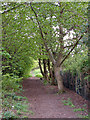
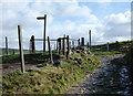
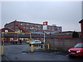
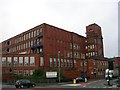
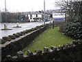

73 photos from this area
Area Information
Key information about the OL2 8JS including its size, population, and administrative classification.
- Area Type
- Postcode
- Area Size
- 9723 m²
- Population
- 1406
- Population Density
- 3344 people/km²
House Prices in OL2 8JS
30
Properties
£107,878
Average Sold Price
£925
Lowest Price
£229,950
Highest Price
Showing 30 properties
| Address | Type | Beds | Baths | Last Sale Price | Last Sale Date | |
|---|---|---|---|---|---|---|
| 17 Bidston Close, Shaw, OL2 8JS | Bungalow | 2 | 1 | £178,000 | Jun 2025 | |
| 11 Bidston Close, Shaw, OL2 8JS | Semi-detached | 3 | 1 | £210,000 | Mar 2022 | |
| 15 Bidston Close, Shaw, OL2 8JS | Bungalow | - | - | £229,950 | Dec 2021 | |
| 23 Bidston Close, Shaw, OL2 8JS | Bungalow | 3 | 1 | £925 | May 2019 | |
| 21 Bidston Close, Shaw, OL2 8JS | Bungalow | - | - | £130,000 | Apr 2019 | |
| 7 Bidston Close, Shaw, OL2 8JS | Semi-detached | 3 | 1 | £140,000 | May 2017 | |
| 1 Bidston Close, Shaw, OL2 8JS | Semi-detached | 3 | 1 | £145,000 | Aug 2016 | |
| 29 Bidston Close, Shaw, OL2 8JS | Bungalow | - | - | £190,000 | Nov 2015 | |
| 19 Bidston Close, Shaw, OL2 8JS | Bungalow | 2 | 1 | £145,000 | Mar 2014 | |
| 14 Bidston Close, Shaw, OL2 8JS | Bungalow | - | - | £80,000 | May 2012 |
Page 1 of 3
Energy Efficiency in OL2 8JS
Amenities
Schools
| Rank | School | Type | Entry gender | Ages |
|---|
Explore more schools in this area
Go to Schools tabDemographics
Household Size
Two person
most common
Accommodation Type
Houses
most common
Tenure
68
majority
Ethnic Group
White
most common
Religion
N/A
most common
Household Composition
N/A
most common
Age
47
median
Adults (30-64 years)
most common
Household Deprivation
N/A
with no deprivation
NS-SEC
28
in Lower managerial occupations
Explore more demographic insights in this area
Go to Demographics tabPlanning
Planning Constraints
- Flood RiskPremium
- Ramsar Wetland SitesPremium
- Area of Outstanding Natural BeautyPremium
- Protected Nature ReservePremium
- Protected WoodlandPremium