Area Overview for OL2 8HB
Photos of OL2 8HB
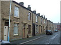
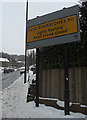


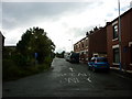
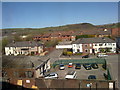
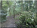
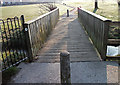


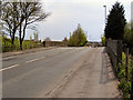

78 photos from this area
Area Information
Key information about the OL2 8HB including its size, population, and administrative classification.
- Area Type
- Postcode
- Area Size
- 9.3 hectares
- Population
- 1425
- Population Density
- 6145 people/km²
House Prices in OL2 8HB
26
Properties
£92,829
Average Sold Price
£35,500
Lowest Price
£168,000
Highest Price
Showing 26 properties
| Address | Type | Beds | Baths | Last Sale Price | Last Sale Date | |
|---|---|---|---|---|---|---|
| 61 Linney Lane, Shaw, OL2 8HB | Semi-detached | 3 | 1 | £168,000 | Feb 2024 | |
| 13 Linney Lane, Shaw, OL2 8HB | Detached | 4 | 1 | £114,000 | Jan 2024 | |
| 15 Linney Lane, Shaw, OL2 8HB | house | - | - | £102,500 | Jan 2022 | |
| 79 Linney Lane, Shaw, OL2 8HB | house | - | - | £129,995 | Mar 2020 | |
| 71 Linney Lane, Shaw, OL2 8HB | Detached | 3 | - | £90,000 | Feb 2018 | |
| 59 Linney Lane, Shaw, OL2 8HB | Terraced | 3 | 1 | £115,000 | Oct 2016 | |
| 69 Linney Lane, Shaw, OL2 8HB | Detached | 4 | - | £98,000 | May 2013 | |
| 1 Linney Lane, Shaw, OL2 8HB | Terraced | - | - | £78,000 | Nov 2005 | |
| 65 Linney Lane, Shaw, OL2 8HB | house | - | - | £98,950 | Jun 2005 | |
| 3 Linney Lane, Shaw, OL2 8HB | Terraced | - | - | £45,000 | Jan 2002 |
Page 1 of 3
Energy Efficiency in OL2 8HB
Amenities
Schools
| Rank | School | Type | Entry gender | Ages |
|---|
Explore more schools in this area
Go to Schools tabDemographics
Household Size
One person
most common
Accommodation Type
Houses
most common
Tenure
47
majority
Ethnic Group
White
most common
Religion
N/A
most common
Household Composition
N/A
most common
Age
47
median
Adults (30-64 years)
most common
Household Deprivation
N/A
with no deprivation
NS-SEC
23
in Lower managerial occupations
Explore more demographic insights in this area
Go to Demographics tabPlanning
Planning Constraints
- Flood RiskPremium
- Ramsar Wetland SitesPremium
- Area of Outstanding Natural BeautyPremium
- Protected Nature ReservePremium
- Protected WoodlandPremium