Area Overview for OL2 8BL
Photos of OL2 8BL
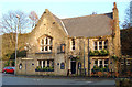
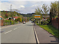
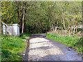
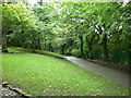
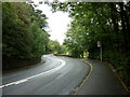
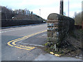
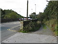
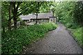
59 photos from this area
Area Information
Key information about the OL2 8BL including its size, population, and administrative classification.
- Area Type
- Postcode
- Area Size
- 1.6 hectares
- Population
- 1527
- Population Density
- 2138 people/km²
House Prices in OL2 8BL
23
Properties
£175,025
Average Sold Price
£55,000
Lowest Price
£430,000
Highest Price
Showing 23 properties
| Address | Type | Beds | Baths | Last Sale Price | Last Sale Date | |
|---|---|---|---|---|---|---|
| 388 Milnrow Road, Shaw, OL2 8BL | Terraced | 2 | 1 | £143,500 | Aug 2025 | |
| 380 Milnrow Road, Shaw, OL2 8BL | Terraced | 2 | 1 | £135,000 | Dec 2023 | |
| 390 Milnrow Road, Shaw, OL2 8BL | house | - | - | £222,500 | Nov 2022 | |
| 400 Milnrow Road, Shaw, OL2 8BL | Semi-detached | 3 | 2 | £260,000 | Apr 2022 | |
| Park Barn, Higher Park, Shaw, OL2 8BL | house | 4 | 1 | £430,000 | Jun 2018 | |
| 392 Milnrow Road, Shaw, OL2 8BL | house | - | - | £113,000 | Apr 2018 | |
| 378 Milnrow Road, Shaw, OL2 8BL | Terraced | 2 | 1 | £130,000 | Dec 2017 | |
| 402 Milnrow Road, Shaw, OL2 8BL | Semi-detached | 3 | 1 | £170,000 | Dec 2016 | |
| 386 Milnrow Road, Shaw, OL2 8BL | Terraced | 2 | 1 | £124,000 | Nov 2016 | |
| Park Farm, Milnrow Road, Shaw, OL2 8BL | house | 4 | 1 | £275,000 | Nov 2012 |
Page 1 of 3
Energy Efficiency in OL2 8BL
Amenities
Schools
| Rank | School | Type | Entry gender | Ages |
|---|
Explore more schools in this area
Go to Schools tabDemographics
Household Size
One person
most common
Accommodation Type
Houses
most common
Tenure
47
majority
Ethnic Group
White
most common
Religion
N/A
most common
Household Composition
N/A
most common
Age
47
median
Adults (30-64 years)
most common
Household Deprivation
N/A
with no deprivation
NS-SEC
25
in Lower managerial occupations
Explore more demographic insights in this area
Go to Demographics tabPlanning
Planning Constraints
- Flood RiskPremium
- Ramsar Wetland SitesPremium
- Area of Outstanding Natural BeautyPremium
- Protected Nature ReservePremium
- Protected WoodlandPremium