Area Overview for OL2 7PG
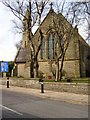
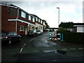
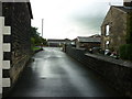
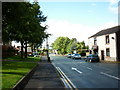
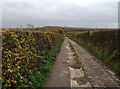
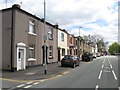
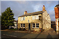
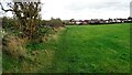
Photos of OL2 7PG


Area Information
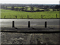
OL2 7PG represents a specific residential cluster in the OL2 postcode area, encompassing a small defined neighbourhood. This area accommodates 1,564 residents across a tightly packed environment, creating a population density of 1,353 people per square kilometre. For anyone considering living in this postcode, the reality is one of high density within a compact footprint. The layout is designed for immediate proximity among neighbours, which shapes the daily rhythm for households residing here. It is a defined zone rather than a sprawling district, meaning your commute or walk to local services occurs within a very short radius. The character of the area is dictated by these boundaries, creating a self-contained community feel. When you look at homes in OL2 7PG, you are entering an established setting where every resident is part of a larger but concentrated whole. The small size of the area means that you will know exactly where you are, with no ambiguity about your location within the broader Rochdale or Greater Manchester context.
- Area Type
- Postcode
- Area Size
- Not available
- Population
- 1564
- Population Density
- 1353 people/km²
The property market in OL2 7PG is characterised by a strong leaning towards owner-occupation rather than rental investment. With 84% of residents owning their homes, the area functions as a settled residential zone where ownership is the norm. The accommodation type is strictly houses, which dictates the purchase landscape for anyone looking at homes in this specific postcode. Potential buyers should expect to find chiefly detached or semi-detached properties rather than purpose-built blocks of flats. This composition reflects a market where families choose to settle down and raise households in traditional housing forms. The low density in terms of accommodation variety means the supply of homes is limited to this single property style. For first-time buyers or investors seeking flats, this area will not meet those needs. Instead, the market caters to those wishing to purchase a traditional house structure. The high ownership rate suggests that selling may take time outside of urgent transactions, as owners are generally settled.
House Prices in OL2 7PG
No properties found in this postcode.
Energy Efficiency in OL2 7PG
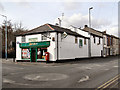
Your lifestyle in OL2 7PG benefits from a cluster of amenities within practical reach. For daily shopping needs, you will find Tesco Shaw, Iceland Shaw, and Co-op Shaw nearby. These specific venues offer the essentials without requiring a long drive to larger retail parks. Transport links are also well-defined, with five metro stops including Shaw and Crompton, Newhey, and Milnrow readily accessible. You can also utilise five railway stations such as Rochdale Railway Station, Castleton Railway Station, and Smithy Bridge Railway Station for broader travel connections. The availability of five retail options, five metro points, and five rail stations indicates a convenient location for commuting or running errands. Living here places you close to established retail hubs and transport nodes. While the area lacks large leisure parks or specialized dining venues listed in the immediate data, the convenience of local supermarkets and direct train links compensates for this.
Amenities
Schools
Families residing near OL2 7PG have access to several educational institutions within the vicinity. You can find St Mary's CofE Primary School High Crompton, which holds a 'good' Ofsted rating for its performance and standards. There is also Crompton House CofE School, which serves as a primary education option for younger children in the catchment area. For secondary or further secondary education, The Crompton House Church of England Academy operates in the region and similarly carries a 'good' Ofsted rating. This mix of Church of England primary schools and an academy provides options for different educational philosophies while maintaining high standards. When looking for schools near OL2 7PG, you see a concentration of state-funded establishments with verified quality ratings. The presence of two primary schools and one academy means you do not have to travel far for schooling. However, all listed institutions fall under the broader Crompton educational network, suggesting a consistent local approach to education.
| Rank | School | Type | Entry gender | Ages |
|---|
Explore more schools in this area
Go to Schools tabDemographics
The community in OL2 7PG is defined by its age and home ownership patterns. The median age stands at 47 years, and the most common age range consists of adults between 30 and 64 years old. This demographic profile suggests a neighbourhood dominated by working families and established professionals rather than young singles or retirees. Home ownership rates are significantly high at 84%, indicating that the majority of households in this postcode sector own their properties outright or via mortgage. This ownership figure contrasts with areas where renting is more common, pointing to a stable long-term resident base rather than a transient population. The predominant ethnic group is White, which aligns with the broader regional composition of the area. Accommodation types are exclusively houses, meaning you will not find flats or apartments within this specific cluster. These facts define the social fabric; when living in OL2 7PG, you join a community of adult homeowners living in detached or semi-detached housing.
Household Size
Accommodation Type
Tenure
Ethnic Group
Religion
Household Composition
Age
Household Deprivation
NS-SEC
Explore more demographic insights in this area
Go to Demographics tabPlanning
Planning Constraints
- Flood RiskPremium
- Ramsar Wetland SitesPremium
- Area of Outstanding Natural BeautyPremium
- Protected Nature ReservePremium
- Protected WoodlandPremium