Area Overview for OL2 6RR
Photos of OL2 6RR
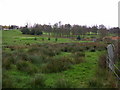
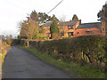
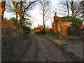
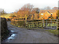
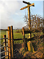
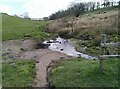
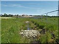
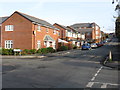
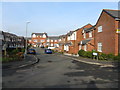
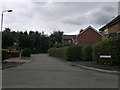
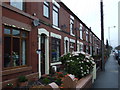
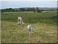
21 photos from this area
Area Information
Key information about the OL2 6RR including its size, population, and administrative classification.
- Area Type
- Postcode
- Area Size
- 5.9 hectares
- Population
- 1734
- Population Density
- 2343 people/km²
House Prices in OL2 6RR
27
Properties
£160,872
Average Sold Price
£73,000
Lowest Price
£560,000
Highest Price
Showing 27 properties
| Address | Type | Beds | Baths | Last Sale Price | Last Sale Date | |
|---|---|---|---|---|---|---|
| 203 High Barn Road, Royton, OL2 6RR | Semi-detached | 3 | 1 | £75,000 | Sep 2024 | |
| 236 High Barn Road, Royton, OL2 6RR | house | - | - | £120,000 | Jun 2021 | |
| 223 High Barn Road, Royton, OL2 6RR | Semi-detached | 3 | 1 | £175,000 | Jun 2021 | |
| 199 High Barn Road, Royton, OL2 6RR | house | - | - | £560,000 | Dec 2020 | |
| 216 High Barn Road, Royton, OL2 6RR | house | - | - | £130,000 | Jun 2017 | |
| 221 High Barn Road, Royton, OL2 6RR | Semi-detached | 3 | 1 | £170,000 | Jun 2017 | |
| 227 High Barn Road, Royton, OL2 6RR | house | - | - | £160,000 | Jun 2014 | |
| 211 High Barn Road, Royton, OL2 6RR | Semi-detached | - | - | £165,000 | Dec 2007 | |
| 214 High Barn Road, Royton, OL2 6RR | Semi-detached | 3 | 2 | £100,000 | Oct 2007 | |
| 238 High Barn Road, Royton, OL2 6RR | Detached | 6 | 3 | £299,950 | Sep 2006 |
Page 1 of 3
Energy Efficiency in OL2 6RR
Amenities
Schools
| Rank | School | Type | Entry gender | Ages |
|---|
Explore more schools in this area
Go to Schools tabDemographics
Household Size
Family (3-5 people)
most common
Accommodation Type
Houses
most common
Tenure
79
majority
Ethnic Group
White
most common
Religion
N/A
most common
Household Composition
N/A
most common
Age
47
median
Adults (30-64 years)
most common
Household Deprivation
N/A
with no deprivation
NS-SEC
35
in Lower managerial occupations
Explore more demographic insights in this area
Go to Demographics tabPlanning
Planning Constraints
- Flood RiskPremium
- Ramsar Wetland SitesPremium
- Area of Outstanding Natural BeautyPremium
- Protected Nature ReservePremium
- Protected WoodlandPremium