Area Overview for OL2 5JX
Photos of OL2 5JX
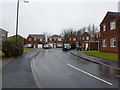


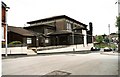
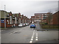
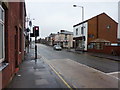
50 photos from this area
Area Information
Key information about the OL2 5JX including its size, population, and administrative classification.
- Area Type
- Postcode
- Area Size
- 1.5 hectares
- Population
- 1526
- Population Density
- 3942 people/km²
House Prices in OL2 5JX
10
Properties
£120,000
Average Sold Price
£120,000
Lowest Price
£120,000
Highest Price
Showing 10 properties
| Address | Type | Beds | Baths | Last Sale Price | Last Sale Date | |
|---|---|---|---|---|---|---|
| 3 Fitton Street, Royton, OL2 5JX | Semi-detached | 2 | 1 | £120,000 | Jun 2018 | |
| Uk Electronics Ltd, 1-4, Floors, Lion Mill, Fitton Street, Royton, OL2 5JX | Industrial | - | - | - | - | |
| Unique Polishing, Basement, Lion Mill, Fitton Street, Royton, OL2 5JX | Industrial | - | - | - | - | |
| Bradshaw Pattern Co Ltd, Rowland House, Lion Mill, Fitton Street, Royton, OL2 5JX | Industrial | - | - | - | - | |
| Glass Studio, Lion Mill, Fitton Street, Royton, OL2 5JX | Industrial | - | - | - | - | |
| 1 Fitton Street, Royton, OL2 5JX | house | - | - | - | - | |
| Schofield House, Lion Mill, Fitton Street, Royton, OL2 5JX | office_workshop | - | - | - | - | |
| Part Basement J And D Andre, Lion Mill, Fitton Street, Royton, OL2 5JX | Industrial | - | - | - | - | |
| Macdonald And Taylor Ltd, Lion Mill, Fitton Street, Royton, OL2 5JX | Industrial | - | - | - | - | |
| Hope Works, Fitton Street, Royton, OL2 5JX | Industrial | - | - | - | - |
Energy Efficiency in OL2 5JX
Amenities
Schools
| Rank | School | Type | Entry gender | Ages |
|---|
Explore more schools in this area
Go to Schools tabDemographics
Household Size
One person
most common
Accommodation Type
Houses
most common
Tenure
46
majority
Ethnic Group
White
most common
Religion
N/A
most common
Household Composition
N/A
most common
Age
47
median
Adults (30-64 years)
most common
Household Deprivation
N/A
with no deprivation
NS-SEC
24
in Lower managerial occupations
Explore more demographic insights in this area
Go to Demographics tabPlanning
Planning Constraints
- Flood RiskPremium
- Ramsar Wetland SitesPremium
- Area of Outstanding Natural BeautyPremium
- Protected Nature ReservePremium
- Protected WoodlandPremium