Area Overview for OL2 5DJ
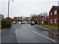
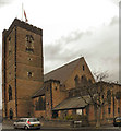
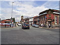
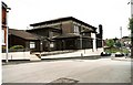
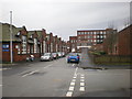
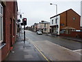
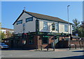
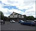
Photos of OL2 5DJ
Area Information
Living in OL2 5DJ means residing in a compact residential cluster covering just 2.4 hectares within Oldham. This tightly defined postcode area houses a population of 1,529 individuals, resulting in a high population density of 62,788 people per square kilometre. You will find yourself in a distinctly built-up environment rather than a sprawling suburb, where homes are situated in close proximity to one another. The character of this neighbourhood is shaped by its small footprint, which fosters an intimate sense of community among residents. Daily life here revolves around the immediate local sphere, relying heavily on nearby transport links and amenities rather than vast green spaces or isolated pockets of housing. For those seeking a home in OL2 5DJ, the reality is a focus on efficiency and proximity. The area functions as a self-contained unit where the distinction between street and neighbour is minimal. You are navigating a space where every drop of surface area is utilised for residential purposes. This concentration creates a specific type of living rhythm, dependent on the quality of surrounding infrastructure to compensate for the lack of open land. The location appeals to individuals who prioritise established neighbourhoods over the novelty of undeveloped terrain. Understanding the scale of OL2 5DJ helps you appreciate the practicalities of moving to such a dense urban pocket.
- Area Type
- Postcode
- Area Size
- 2.4 hectares
- Population
- 1529
- Population Density
- 2859 people/km²
The property market in OL2 5DJ is dominated by existing homeowners rather than new entrants or a rental sector. With 73 per cent of the population owning their homes, the area functions primarily as an owner-occupied zone. This high level of tenure stability indicates that the housing stock is not constantly churning through sales and lets. The type of accommodation is exclusively houses, meaning you will not find apartments or flats within this specific postcode cluster. This factual detail is crucial for buyers; if your requirement is a semi-detached property or a detached house, OL2 5DJ is the correct location. If you are seeking a flat for a smaller footprint, this area does not offer that option. The dominance of house ownership affects the local economy, as equity is stored in the homes rather than liquid within the rental market. For those looking at homes in OL2 5DJ, the transaction process may involve dealing with well-established owners who have likely upgraded or moved previously. The scarcity of rental options means that renting here is less common than buying. Any new development is unlikely given the area size and current occupancy rates. You must be prepared to either purchase an existing house or join the inheritance of a property previously owned by a member of this established community.
House Prices in OL2 5DJ
Showing 10 properties
| Address | Type | Beds | Baths | Last Sale Price | Last Sale Date | |
|---|---|---|---|---|---|---|
| 138 Oldham Road, Royton, OL2 5DJ | house | - | - | £185,000 | Jul 2025 | |
| 128 Oldham Road, Royton, OL2 5DJ | house | - | - | £114,000 | Feb 2019 | |
| 134 Oldham Road, Royton, OL2 5DJ | Semi-detached | 2 | 1 | £87,000 | Jul 2015 | |
| 126 Oldham Road, Royton, OL2 5DJ | Detached | 3 | - | £91,500 | Nov 2006 | |
| 122 Oldham Road, Royton, OL2 5DJ | house | 5 | - | £38,000 | May 1999 | |
| 140 Oldham Road, Royton, OL2 5DJ | Terraced | - | - | - | - | |
| 130 Oldham Road, Royton, OL2 5DJ | house | - | - | - | - | |
| 132 Oldham Road, Royton, OL2 5DJ | house | - | - | - | - | |
| 136 Oldham Road, Royton, OL2 5DJ | Terraced | - | - | - | - | |
| 124 Oldham Road, Royton, OL2 5DJ | house | 2 | 1 | - | - |
Energy Efficiency in OL2 5DJ
Your daily lifestyle in OL2 5DJ is supported by a concentrated array of amenities within practical reach. For retail needs, you can visit five nearby shops, including Co-op Royton, Lidl Royton, and Spar. These locations provide for essential grocery shopping and convenience needs without a long journey. Transport connectivity is equally immediate, as you are near five metro stops like Derker and Westwood, allowing easy access to the wider transit network. You also have access to five railway stations, including Mills Hill and Castleton, which serve as gateways to other towns. While the area is 2.4 hectares of housing, the surrounding infrastructure brings the city to your doorstep. Dining and social activities will likely involve a short walk or bus ride to these established retail and transit points. The lack of large parks or leisure centres within the immediate data suggests a lifestyle focused on residential comfort and external exploration. You plan your evenings around the availability of shops near Co-op or Spar, and your weekends around the transport links to Metro stations. This practical connectivity means you do not need to travel far for basic goods, but you may need to move slightly for extended leisure activities. The character of your life here is defined by this efficient use of nearby resources.
Amenities
Schools
Families living in OL2 5DJ have access to a specific set of educational institutions nearby, catering to different primary and secondary needs. The closest primary education provision is St Anne's CofE (Aided) Primary School, which holds a Good rating from Ofsted. This school offers a faith-based education environment for young children. For parents requiring a principal school, Our Lady's RC High School serves as a primary option listed for the area, though specific performance data is not detailed in the current records. For secondary education, families must look to E-ACT the Oldham Academy North. This academy also carries a Good Ofsted rating, ensuring a standard of quality recognised by the educational framework. The mix of Church of England, Roman Catholic, and Academy provisions shows a diverse institutional approach to learning. You will find that the immediate zone supports primary education directly, while secondary options rely on this specific academy. When schools near OL2 5DJ are considered, the strength of these ratings provides a reassuring baseline for educational standards. Parents can expect schools that have passed rigorous government inspections. The presence of a dedicated academy suggests a modern, state-funded approach to secondary schooling for the wider neighbourhood.
| Rank | School | Type | Entry gender | Ages |
|---|
Explore more schools in this area
Go to Schools tabDemographics
The community in OL2 5DJ is defined by a mature demographic profile with a median age of 47 years. The most common age range comprises adults between 30 and 64 years old, indicating a stability often associated with families and established households. Over 73 per cent of the area is comprised of owner-occupiers, which creates a stable, long-term residential fabric. The overwhelming majority of accommodation consists of houses, reinforcing the nature of the terrain as established residential terraces or detached properties rather than high-rise blocks or rented flats. While the data identifies a predominant ethnic group of White residents, the focus remains on the structural composition of the household rather than deep cultural breakdowns. This high rate of home ownership suggests that many residents have invested deeply in their local environment and show a strong intention to remain. The age distribution implies a lack of young families or recent retirees, pointing instead towards working professionals or established parents. This demographic reality means the social fabric is likely geared towards stability and mutual support among long-term neighbours. When considering homes in OL2 5DJ, you are joining a cohort that has settled down and secured their property status.
Household Size
Accommodation Type
Tenure
Ethnic Group
Religion
Household Composition
Age
Household Deprivation
NS-SEC
Explore more demographic insights in this area
Go to Demographics tabPlanning
Planning Constraints
- Flood RiskPremium
- Ramsar Wetland SitesPremium
- Area of Outstanding Natural BeautyPremium
- Protected Nature ReservePremium
- Protected WoodlandPremium